Disclosure : This site contains affiliate links to products. We may receive a commission for purchases made through these links.
Himalaya ITMB
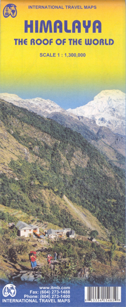
Himalayas at 1:1,300,000 from ITMB, providing coverage from Kabul and the Hindu Kush to the north-eastern states of India and eastern Tibet. The map is double-sided, with a separate index for each side, and drawn with north-northeast at the top.Coverage on one side extends from Kabul across northern Pakistan to Delhi, western Nepal and Mount Kailas in Tibet. On the reverse is the remainder of Nepal, Sikkim, Bhutan, southern Tibet with Lhasa and beyond, plus most the north-eastern states of India.Altitude colouring shows the topography, with additional graphics for glaciers, plus spot heights and names of individual mountain ranges. The map shows the region’s road and rail networks and highlights various places of interest. Within India, Pakistan and Afghanistan internal administrative boundaries are shown with the names of the state/provinces. Latitude and longitude lines are drawn at intervals of 2ยฐ.

Related Products:
 Everest & Himalaya ITMB
 Bangladesh & India East ITMB
 India Road Edition Wall Map
 Sikkim & India Northeast ITMB
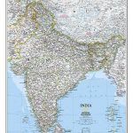 India NGS Classic Wall Map ENCAPSULATED
 India NGS Classic Wall Map PAPER
 India South & North East ITMB
 Tibet ITMB
South Asia Upside Down Himal Southasian Wall Map
Kabul & Historic Khyber Pass ITMB
Tibet ITMB
South Asia Upside Down Himal Southasian Wall Map
Kabul & Historic Khyber Pass ITMB
 India F&B
 India North Borch
 India North East & Kolkata / Calcutta ITMB
 Afghanistan and Pakistan NGS Classic Wall Map PAPER
 China South ITMB
 India IGN Map 85115
 India North and West ITMB
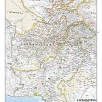
 Afghanistan ITMB
Kamchatka & Eastern Siberia ITMB
Afghanistan ITMB
Kamchatka & Eastern Siberia ITMB
 Afghanistan Nelles Map
 India Northeast Reise Know-How
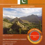
 Pakistan ITMB
 Argentina South & Tierra del Fuego ITMB
Sri Lanka & India South ITMB
Argentina South & Tierra del Fuego ITMB
Sri Lanka & India South ITMB
 Nepal ITMB
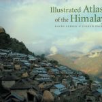 Illustrated Atlas of the Himalaya
 Africa Western ITMB
 Africa Northwest ITMB
 Africa North ITMB
 Afghanistan – Kabul & 5 Cities Gizi Map
 South America ITMB Travel Atlas
 Pakistan Gizi Map
 Alice Springs to Uluru (Ayers Rock)
 Great Lakes ITMB
Afghanistan – Kabul & 5 Cities Street Plans Gizi Wall Map
Great Lakes ITMB
Afghanistan – Kabul & 5 Cities Street Plans Gizi Wall Map
 India ITMB
 China North-East Wall Map
 Bosnia & Montenegro ITMB
 Indian Himalaya terraQuest Trekking Map