Disclosure : This site contains affiliate links to products. We may receive a commission for purchases made through these links.
Highwood & Cataract Creek – Kananaskis Country Gem Trek Map

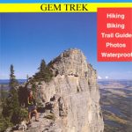
Highwood and Cataract Creek area of the Canadian Rockies on a contoured and GPS compatible, waterproof and tear-resistant map at 1:50,000 from Gem Trek with descriptions of recommended trails and other tourist information. On the reverse an inset at 1:50 000 extends the coverage south to take in the trails accessed from Highways 940 and 542, including Pasque Mountain, Plateau Mountain, Hailstone Butte Fire Lookout and Indian Graves Ridge. Also provided are trail descriptions and photos of 18 recommended day hikes, two overnight trips and three classic mountain bike rides, plus contact information for visitor centres, campgrounds, hotels and lodges, etc.To see the list of titles in this series please click on the series link.


