Disclosure : This site contains affiliate links to products. We may receive a commission for purchases made through these links.
Highway 395 – Carson City NV to Lone Pine CA Benchmark Road Map
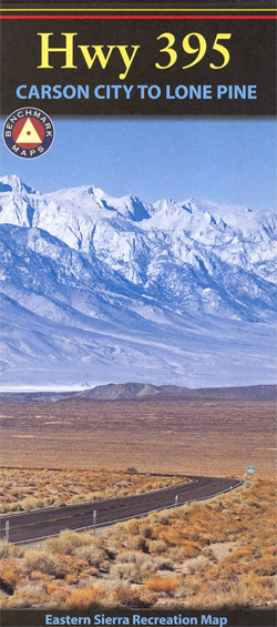
Highway 395’s most scenic section, from the capital of Nevada, Carson City, to Lone Pine in California along the eastern edge of the Sierra Nevada on a detailed, double-sided map at 1:213,220 (1 inch to 4 miles) from Benchmark Maps.The map highlights the route and shows the surrounding road network which provides access both to Sierra Nevada to the west and to the mountains and valleys on its eastern side. Unpaved roads indicate routes requiring 4WD or high clearance vehicles. The map also shows which routes across the Sierra Nevada are closed in winter.Relief shading with spot heights and plenty of names of peaks, valleys, etc. shows the region’s topography. The map shows boundaries of national parks or forests and other protected areas. Rest or picnic areas, campgrounds and RV parks, historic sites and other places of interest are highlighted. The map has no geogarphical coordinates. The index list towns, national parks and forests, as well as physical and water features. Also provided are notes about the route and its highlights.

Related Products:
 Montana Benchmark Road & Recreation Atlas
 Oregon Benchmark Road & Recreation Atlas
Wyoming Benchmark Road & Recreation Atlas
Oregon Benchmark Road & Recreation Atlas
Wyoming Benchmark Road & Recreation Atlas
 Idaho Benchmark Road & Recreation Atlas
 California Benchmark Road & Recreation Atlas
 USA: Benchmark Road and Recreational Atlases of Western USA
 New Mexico Benchmark Road & Recreation Atlas
 Sierra Nevada Destination Map
 Arizona Benchmark Road & Recreation Atlas
 California Benchmark Road Map
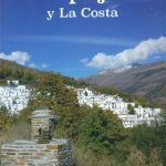 La Alpujarra and La Costa Editorial Penibetica
 Andalusia Autonomous Community CNIG Physical Road Map
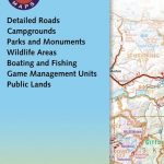
 Nevada Road & Recreation Atlas
 South Tyrol – Dolomites Tabacco Road and Panorama Map
 Dolomites ‘“ Lake Garda ‘“ Verona – Venice 200K Tabacco Road & Panorama Map
USA: Benchmark Maps State Road Maps
Dolomites ‘“ Lake Garda ‘“ Verona – Venice 200K Tabacco Road & Panorama Map
USA: Benchmark Maps State Road Maps
 Utah Benchmark Recreation Map
 Oregon Benchmark Recreational Map
 Washington State Benchmark Recreation Map
 USA: Antenna Audio American Highway Road Atlas – A3, PAPERBACK
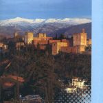
 Sierra Nevada
 Idaho Benchmark Recreational Map
 California – Nevada USA 05 Hallwag Road Map
 Sierra Nevada – the Traverse at 3000m Editorial Piolet
 Alsace – Vosges K+F Road Map
 South Africa – Namibia – Botswana Hallwag Road Map
 Oregon Road & Recreation Atlas
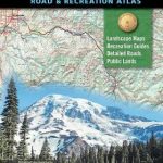 Washington State Road & Recreation Atlas
 Pyrenees 350K Editorial Alpina Road Map
 Aragรณn Autonomous Region 300K CNIG Physical Road Map
 Catalonia Auotomous Community CNIG Physical Road Map
 USA: Antenna Audio American Highway Road Atlas – A4, PAPERBACK
 Canary Islands Autonomous Region 350K CNIG Physical Road Map
 Silk Road Countries
 Catalonia Editorial Alpina Road Map
 Nepal – Great Himalaya Trail and National Parks
 Oregon & Northern California Coast Road & Recreation Map
 Silk Road Countries Wall Map
 Sierra Nevada – Las Alpujarras CNIG Map
Murcia Autonomous Region 200K CNIG Physical Road Map
Sierra Nevada – Las Alpujarras CNIG Map
Murcia Autonomous Region 200K CNIG Physical Road Map