Disclosure : This site contains affiliate links to products. We may receive a commission for purchases made through these links.
High Jura – Northern Alps IGN Top200 202

Pyrรฉnรฉes Ouest map from the IGN at 1:200,000, with excellent presentation of the terrain through contours and vivid relief shading, plenty of names of topographic features, long-distance GR hiking routes, places of interest, etc. The map is designed to provide convenient coverage of the western and central part of the Pyrenees, extending across the highest part of the mountains to St-Girons. The overprint highlights both the GR10 and the GR 11 on the Spanish side.The mapping is a hybrid from two of IGN’s series. Road information and the highlighting for picturesque towns or villages and other places of interest is a direct enlargement of the publishers’ Regional series at 1:250,000. Presentation of the topography follows that in IGN’s highly popular TOP100 series to provide a better picture each region’s mountainous terrain. Contours are at 100m intervals, enhanced by vivid relief shading and spot heights, plus plenty of names of mountain ranges, peaks, valleys, etc. An overprint highlights GR routes and connecting other trails. The maps have no geographical coordinates. The index is next to the map. Map legend includes English.

Related Products:
 Southern Alps IGN Top200 203
 Massif Central IGN Top200 204
Pyrenees West IGN Top200 205
Massif Central IGN Top200 204
Pyrenees West IGN Top200 205
 Pyrenees East IGN Top200 206
Massif des Vosges – Plaine d`Alsace IGN Top200 201
Pyrenees East IGN Top200 206
Massif des Vosges – Plaine d`Alsace IGN Top200 201
 France: IGN 200K Tourist Maps
 Julian Alps – Steiner Alps – Kamnik Alps Kompass 2801
 Pfaffenwinkel – Northern Ammergau Alps UK50-49
Krakรณw-Czestochowa Jura – Northern Part ExpressMap Tourist Map
Pfaffenwinkel – Northern Ammergau Alps UK50-49
Krakรณw-Czestochowa Jura – Northern Part ExpressMap Tourist Map
 Tongariro Northern Circuit and Tongariro Alpine Crossing
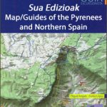 Spain: Sua Edizioak Map/Guides of the Pyrenees and Northern Spain
 Cami de l`Ossa – Andorra Editorial Piolet
 Krakรณw ‘“ Czestochowa Jura
 Swabian Jura: Mรผnsinger Alb 35K Kรผmmerly + Frey Map No. 42
 Julian Alps East – Bohinj – Triglav Tabacco 065
 Swabian Jura: Hohenzollern 35K Kรผmmerly + Frey Map No. 41
 Chiemgau Alps East – Sonntagshorn Alpenverein KOMBI BY19
 From l`Ametlla de Mar to l`Ampolla
 Nuremberg Land – Franconian Jura
 Chiemgau Alps Central – Hochgern – Hochfelln Alpenverein KOMBI BY18
 Val de Toran
Chiemgau Alps West – Hochries – Geigelstein Alpenverein Komi Map BY17
Val de Toran
Chiemgau Alps West – Hochries – Geigelstein Alpenverein Komi Map BY17
 Siurana
 Italy: IGC 25K Walking Maps of the Italian Alps
 Serra de Llaberia Editorial Piolet
 Jura – Franches-Montagnes – Ajoie K+F Hiking 3
 High Tatras Kompass 2130
 Maritime Alps Natural Park – Entracque – Valdieri – Mercantour – Gelas IGC 113
El Moncayo Editorial Piolet
Maritime Alps Natural Park – Entracque – Valdieri – Mercantour – Gelas IGC 113
El Moncayo Editorial Piolet
 Allgau Alps UK50-47
 Hiking and Trekking in the Japan Alps and Mount Fuji: Northern, Central and Southern Alps
 Geoparque de las Sierras Subbeticas Editorial Piolet
La Laguna Negra ‘“ Picos de Urbiรณn
Chiemsee – Chiemgau Alps UK50-54
Serra de Montsant
Geoparque de las Sierras Subbeticas Editorial Piolet
La Laguna Negra ‘“ Picos de Urbiรณn
Chiemsee – Chiemgau Alps UK50-54
Serra de Montsant
 Tatras High and Western – Belaer Kompass 2100
 Urbion – Viniegras and Sierra de Castejon
 Chiemsee – Chiemgau Alps – Traunstein K+F Outdour Map 7
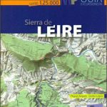 Sierra de Leire Map/Guide
Muntanyes de Prades
Sierra de Leire Map/Guide
Muntanyes de Prades