Disclosure : This site contains affiliate links to products. We may receive a commission for purchases made through these links.
Heywood 1907
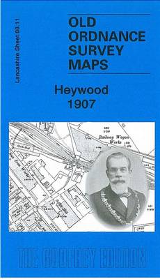
Heywood in 1907 in a fascinating series of reproductions of old Ordnance Survey plans in the Alan Godfrey Editions, ideal for anyone interested in the history of their neighbourhood or family. The map covers the mill town of Heywood, just west of Rochdale. About 35 cotton mills are shown, including Yew Mill, Plum Mill, Roeacre Mill and others. Coverage stretches from Lord Street and Rose Hill Mill eastward to Lane End and Harefield Hall. The Bolton & Bury line runs through the map, including Heywood and Broadfield stations and the railway wagon works. Other features include tramways, Hopwood, Heywood Branch Canal, Captain Fold, All Souls church, St Luke`s church, Cartridge Ropery, Bottom o` th` Brow, Broadfield, Sun Iron Works, Phoenix Brewery, etc. Extracts from a 1918 directory are on the reverse. About the Alan Godfrey Editions of the 25″ OS Series:Selected towns in Great Britain and Ireland are covered by maps showing the extent of urban development in the last decades of the 19th and early 20th century. The plans have been taken from the Ordnance Survey mapping and reprinted at about 15 inches to one mile (1:4,340). On the reverse most maps have historical notes and many also include extracts from contemporary directories. Most maps cover about one mile (1.6kms) north/south, one and a half miles (2.4kms) across; adjoining sheets can be combined to provide wider coverage.FOR MORE INFORMATION AND A COMPLETE LIST OF ALL AVAILABLE TITLES PLEASE CLICK ON THE SERIES LINK.

Related Products:
 Bollington 1907
 Blackrod 1907
Horwich North 1907
Westhoughton 1907
Oswaldtwistle and Church 1909
Blackrod 1907
Horwich North 1907
Westhoughton 1907
Oswaldtwistle and Church 1909
 Barnoldswick 1907
Hopwood Hall and Thornham 1907
Barnoldswick 1907
Hopwood Hall and Thornham 1907
 Newport 1907 – 95.02
Accrington 1909
Horbury 1905
Newport 1907 – 95.02
Accrington 1909
Horbury 1905
 Chorley 1909
 Hayes 1907
 Sevenoaks South 1907
 Sevenoaks North and Riverhead 1907
Bolton South and Great Lever 1927
Bootle Docks & Seaforth 1907 – 99.13
Stourport 1901
Sevenoaks North and Riverhead 1907
Bolton South and Great Lever 1927
Bootle Docks & Seaforth 1907 – 99.13
Stourport 1901
 Liverpool Toxteth Mill Street 1847
Holmfirth 1904
Bangor East 1901
Wigan 1907 – 93.08b
Liverpool Toxteth Mill Street 1847
Holmfirth 1904
Bangor East 1901
Wigan 1907 – 93.08b
 Farnham 1913
 Tottington 1908
Alston 1898
Tottington 1908
Alston 1898
 Lostock Junction 1907
 Cannock South 1902
Bexenden 1909
Malvern Link 1926
East Jarrow 1913
Openshaw 1905
Cannock South 1902
Bexenden 1909
Malvern Link 1926
East Jarrow 1913
Openshaw 1905
 Openshaw 1916
Ashton-under-Lyne 1916
Shut End and Tansey Green 1903
Padiham 1909
Wrexham Central 1909
Barnsley North East 1904
Stockton (North) 1899 – 50.12a
Openshaw 1916
Ashton-under-Lyne 1916
Shut End and Tansey Green 1903
Padiham 1909
Wrexham Central 1909
Barnsley North East 1904
Stockton (North) 1899 – 50.12a
 Rochdale West 1908
Redditch East 1903
South Yardley and Hay Mills 1903
Rochdale West 1908
Redditch East 1903
South Yardley and Hay Mills 1903