Disclosure : This site contains affiliate links to products. We may receive a commission for purchases made through these links.
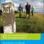
Het Groene Woud

Het Groene Woud” map in 1:25,000 belong to a series of eleven walking from Falk, which cover the most beautiful hiking areas in four regions: North Brabant in the south, the tip of North Holland, Friesland and Groningen in the north of the country.’Het Groene Woud” (the green forest) map covers an area of approximately 26 x 16 km in North Brabant.The maps in this series feature a very detailed topography (landscape information is provided by colouring for woodlands, canals, hills, etc ) and specific information such as the distance in kilometres between junctions, the long distance footpaths and one-day walking tours with description. The paths of walking network are marked with a number. A wide range of symbols shows various accommodation options, bars and restaurants, and various places of interest. Map legend includes English.To see the list of other titles in this series please click on the series link.

Related Products:
 The Brabant Kempen
 De Acht Zaligheden
 North West Friesland
 North East Groningen
 North East Friesland
 Netherlands: Falk/VVV Hiking Maps
 Groene Hart Super-durable Cycling Map
 Brabant West and Central Cycling Map
Flemish Brabant Falkplan Cycling Map 36
Brabant West and Central Cycling Map
Flemish Brabant Falkplan Cycling Map 36
 Ardennes Falkplan Cycling Map 37
 North Holland – with Kennemerland Falkplan Cycling Map 13
North Limburg – De Pell and De Maasduinen Falkplan Cycling Map 19
Netherlands North Cycling Map NL1
South-Holland North – Green Heart West and Bollenstreek Falkplan Cycling Map 14
North Holland – with Kennemerland Falkplan Cycling Map 13
North Limburg – De Pell and De Maasduinen Falkplan Cycling Map 19
Netherlands North Cycling Map NL1
South-Holland North – Green Heart West and Bollenstreek Falkplan Cycling Map 14
 Netherlands North Super-Durable Cycling Map 1
Flevoland – Kop van Overijssel Falkplan Cycling Map 06
Netherlands Falkplan Cycling Atlas
Netherlands North Super-Durable Cycling Map 1
Flevoland – Kop van Overijssel Falkplan Cycling Map 06
Netherlands Falkplan Cycling Atlas
 Belgian Coast Cycling Map 30
 Veluwe Falkplan Cycling Map 09
 Belgian Limburg Cycling Map
 Twente Falkplan Cycling Map 08
Achterhoek Falkplan Cycling Map 10
Twente Falkplan Cycling Map 08
Achterhoek Falkplan Cycling Map 10
 Vechtdal and Salland Cycling Map
Groningen – Lauwersmeer Falkplan Cycling Map
Kempenland – de Meijerij Falkplan Cycling Map 18
Vechtdal and Salland Cycling Map
Groningen – Lauwersmeer Falkplan Cycling Map
Kempenland – de Meijerij Falkplan Cycling Map 18
 Drenthe West Cycling Map
 Drenthe East Cycling Map
Antwerp Kempen Falkplan Cycling Map 32
Vechtdal and Salland Falkplan Cycling Map 07
Drenthe East Cycling Map
Antwerp Kempen Falkplan Cycling Map 32
Vechtdal and Salland Falkplan Cycling Map 07
 Friese Meren – South Friesland Falkplan Cycling Map 03
 West Frisian Islands Falkplan Cycling Map
 Zeeland Islands with Zeelandic Flanders Falkplan Cycling Map 16
Limburg Central and South Falkplan Cycling Map 20
Rivierenland – De Biesbosch – Rijk van Nijmegen Falkplan Cycling Map 11
Drenthe East – Southeast Groningen Falkplan Cycling Map
South-Holland South – Goeree-Overflakkee Falkplan Cycling Map 15
Utrecht Hills – `t Gooi – Vecht area Falkplan Cycling Map 12
Westhoek – South-West Flanders Falkplan Cycling Map 34
Zeeland Islands with Zeelandic Flanders Falkplan Cycling Map 16
Limburg Central and South Falkplan Cycling Map 20
Rivierenland – De Biesbosch – Rijk van Nijmegen Falkplan Cycling Map 11
Drenthe East – Southeast Groningen Falkplan Cycling Map
South-Holland South – Goeree-Overflakkee Falkplan Cycling Map 15
Utrecht Hills – `t Gooi – Vecht area Falkplan Cycling Map 12
Westhoek – South-West Flanders Falkplan Cycling Map 34
 Brabant Provinces (Flemish and Wallon) and Brussels Region
 Zeelandic Flanders – Meetjesland and Waasland Falkplan Cycling Map 31