Disclosure : This site contains affiliate links to products. We may receive a commission for purchases made through these links.
Helsinki City Map & Guide
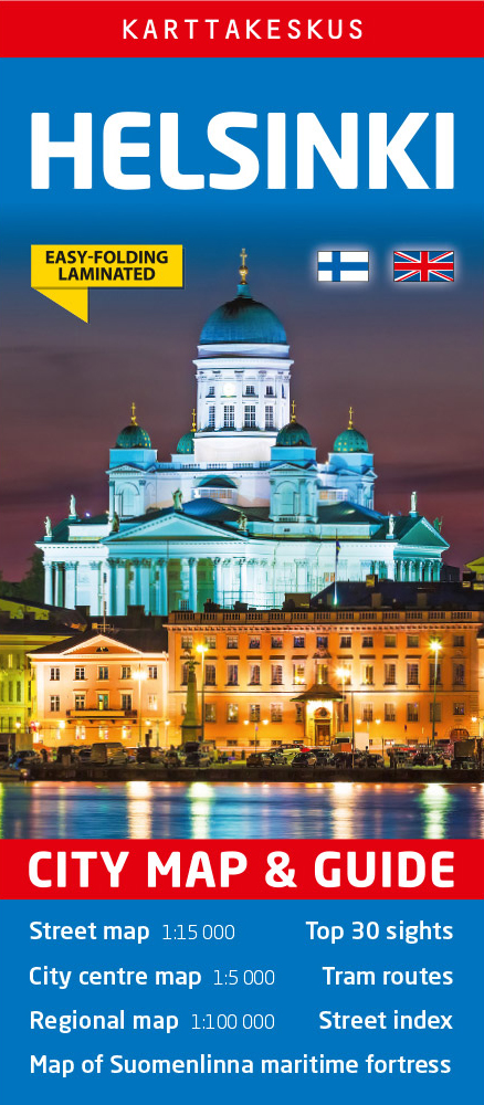
Helsinki on a laminated, waterproof and tear-resistant street plan from Karttakeskus combining a street plan of the city with a detailed enlargement of its town centre, plus a road map of the capital’s environs, a diagram of the tram network, and brief descriptions of 30 most interesting sights prominently highlighted on the plans.Helsinki’s central districts are shown on an indexed street plan at 1:15,000, indicating tram lines with route numbers, metro stations, taxi ranks, one way streets, car parks and petrol stations, ferry terminals, selected hotels, etc. Streets are annotated with selected house numbers for easier identification of addresses. The city centre around the railway station is also shown in much greater detail at 1:5,000. 30 of the city’s most interesting places are prominently marked and cross-referenced to brief descriptions accompanied by small colour photos. The plans are accompanied by a large, clear diagram of Helsinki’s tram network, plus a road map showing the capital’s environs at 1:100,000. Map legend and all the text include English.The map can be customised with suitable marker pens, and is laminated in a way similar to the old cloth-dissected maps, so that sections of it can be easily viewed without damaging the whole sheet.

Related Products:
 Helsinki City Map
 Helsinki & Southern Finland ITMB
 Linz F&B Tourist Street Plan
 Budapest F&B
 Stockholm Borch
 Brussels Marco Polo City Map
 Barcelona Borch
 Warsaw Marco Polo City Map
 Nuremberg City Pocket Plan
 Helsinki F&B
 Innsbruck City Map
 St Petersburg Marco Polo City Map
 Michelin City Maps
 Berlin Marco Polo City Map
 Budapest Marco Polo City Map
 Prague Borch
 Frankfurt Marco Polo City Map
 Rome NGS City Destinations Map
 Lisbon Borch
 Salzburg F&B Tourist Street Plan
 Prague Marco Polo City Map
 Vienna Borch
 Madrid Borch
 Riga City Center Jana Seta Street Plan
 Geneva & Switzerland ITMB
 Riga ITMB
 New York City – Manhattan Michelin City Plan and Index
 Kiel City Pocket Plan
 Lubeck City Pocket Plan
 Munster City Pocket Plan
 Potsdam City Pocket Plan
 Bremen City Pocket Plan
 Dortmund City Pocket Plan
 Stockholm EasyMap
 Washington DC Borch
 Munich & Bavaria ITMB
 Florence Marco Polo City Map
 Paris Borch
 Hamburg City Pocket Plan
 Cologne City Pocket Plan