Disclosure : This site contains affiliate links to products. We may receive a commission for purchases made through these links.
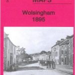
Heckmondwike 1905
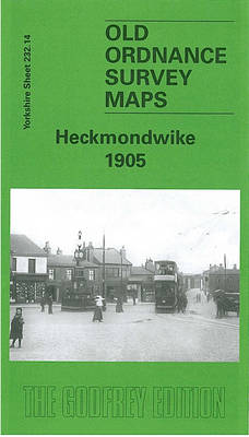
Heckmondwike in 1905 in a fascinating series of reproductions of old Ordnance Survey plans in the Alan Godfrey Editions, ideal for anyone interested in the history of their neighbourhood or family. The map covers much of Heckmondwike and the area to the south, with coverage southward to Liversedge Park Farm and westward to Balm Field and the Huddersfield Road. Features include the disused Park Farm Colliery, Lighthouse Tannery, Dewsbury Moor House, Kilpin Hill Mills, St James church, Market Place, LNWR and LYR stations with railway approaches, Flush Mills, Walkley Mills, Spen Vale Mills, Norristhorpe, Swashland, Milton Square, Headland, Liversedge Hall, Strawberry Bank Colliery, Spen Valley Carpet Works, Wellington Mills, High Street, tramways, etc. An 1889 directory of Heckmondwike is on the reverse.About the Alan Godfrey Editions of the 25″ OS Series:Selected towns in Great Britain and Ireland are covered by maps showing the extent of urban development in the last decades of the 19th and early 20th century. The plans have been taken from the Ordnance Survey mapping and reprinted at about 15 inches to one mile (1:4,340). On the reverse most maps have historical notes and many also include extracts from contemporary directories. Most maps cover about one mile (1.6kms) north/south, one and a half miles (2.4kms) across; adjoining sheets can be combined to provide wider coverage.FOR MORE INFORMATION AND A COMPLETE LIST OF ALL AVAILABLE TITLES PLEASE CLICK ON THE SERIES LINK.

Related Products:
 Wakefield West 1905
 Ivybridge 1905
Old Trafford 1905
Ivybridge 1905
Old Trafford 1905
 East Bierley 1905
 Warrington West 1905
Halifax: Mixenden and South Illingworth 1905
Ossett Central 1905
Abram 1905
Warrington West 1905
Halifax: Mixenden and South Illingworth 1905
Ossett Central 1905
Abram 1905
 Bradford Odsal & Low Moor 1905
Sandwell Hall 1902
Bradford Odsal & Low Moor 1905
Sandwell Hall 1902
 Tong 1905
 Oakenshaw, Low Moor and Wyke 1905
Gunnislake South and Albaston 1905
Oakenshaw, Low Moor and Wyke 1905
Gunnislake South and Albaston 1905
 Allerton 1905
South Yardley and Hay Mills 1903
Allerton 1905
South Yardley and Hay Mills 1903
 Whitstable West 1905
Horbury 1905
Whitstable West 1905
Horbury 1905
 Hanging Heaton 1892
Halifax Ovenden Cross 1905
Hanging Heaton 1892
Halifax Ovenden Cross 1905
 Wavertree and Broad Green 1905
 Liverpool Princes Park 1905
Huddersfield Central 1905
Liverpool Princes Park 1905
Huddersfield Central 1905
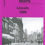 City of Lincoln 1905 – 70.07a
Wick 1905
City of Lincoln 1905 – 70.07a
Wick 1905
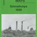 Grimethorpe 1929
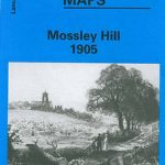 Mossley Hill 1905
 Huddersfield South 1905
Gunnislake North 1905
Sunderland South 1895
Looe 1905
Knutsford South 1908
Huddersfield South 1905
Gunnislake North 1905
Sunderland South 1895
Looe 1905
Knutsford South 1908
 Ebbw Vale (South) 1899 – 11.14
Bellshill 1935 – 11.08
Openshaw 1905
Tavistock 1905
Boscastle 1905
Ebbw Vale (South) 1899 – 11.14
Bellshill 1935 – 11.08
Openshaw 1905
Tavistock 1905
Boscastle 1905
 South Harrow and Northolt Park 1935
Elswick 1913
Wigan West 1908
South Harrow and Northolt Park 1935
Elswick 1913
Wigan West 1908
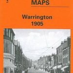 Warrington 1905