Disclosure : This site contains affiliate links to products. We may receive a commission for purchases made through these links.
Havoysund Nordeca Tourist Route 20017

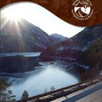
The Havรธysund National Tourist Route Map belongs to a series of 18 map and postcards sets describing popular tourist routes all over Norway. The map set includes a map in 1: 50,000 presenting an accurate topography (based on the Norwegian topographic survey) which describes local footpaths, cycle or ski routes, sport and recreational facilities, places of interest, places to stay and eat, viewpoints.Havรธysund National Tourist Route is a 66-kilometre-long stretch of road between Kokelv and Havรธysund in the county of Finnmark in Northern Norway. The landscape here at 71 degrees north changes quickly from coast and fjord to plateaus and mountains. Locals have always lived from fishing. Fishing opportunities are everywhere, and the rich offshore fishing banks have turned the Arctic Ocean into Norway’s larder. Fishing, hunting and settlements in the area can be traced back 6,000 years. After driving through a landscape that bears little trace of human activity, the little fishing hamlet of Havรธysund comes as a surprise – a busy little community on the Finnmark coast, living from fishing, tourism, and arts and crafts. From Havรธysund you can extend your trip by boat out to Rolvsรธya and Ingรธya in the Arctic Ocean.The set features:One map: scale 1:50,000 Text in three languages (Norwegian, English and German)5 Postcards (13.5x25cm)To see the list of other titles in this series, please click on the series link.

Related Products:
 Varanger Nordeca Tourist Route 20018
 Sognefjellet Nordeca Tourist Route 20008
 Helgeland Coast North Nordeca Tourist Route 20013
 Aurlandsfjellet Nordeca Tourist Route 20005
 Valdresflye Nordeca Tourist Route 20006
 Gaularfjellet Nordeca Tourist Route 20007
 Atlantic Road Nordeca Tourist Route 20012
 Ryfylke Nordeca Tourist Route 20002
 Lofoten Nordeca Tourist Route 20014
 Old Strynefjellsvegen Nordeca Tourist Route 20009
 Norway: Nordeca Regional Touring Maps
 Denmark Tourist Map – Major Cities with the Marguerite Route
 Folgefonna National Park Nordeca 2663
Garden Route & Route 62 Map Studio
Folgefonna National Park Nordeca 2663
Garden Route & Route 62 Map Studio
 Norway Nordeca Sightseeing Map 6010
 Jรธlster Nordeca 2568
 Huldreheimen Nordeca 2489
 Fjordruta Nordeca 2607
 Forollhogna Nordeca 2731
 Reineskarvet Nordeca 2385
 Tafjordfjella Nordeca 2533
 Lygna Nordeca 2600
 Trondheim Nordeca 2665
 Lysefjorden Nordeca 2681
 Skarverennet Nordeca 2703
 Norway Walking
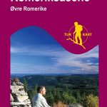 Romeriksรฅsene Nordeca 2225
 Lofoten Nordeca 2549
 Blefjell Nordeca 2207
 Lifjell Nordeca 2219
 Jotunheimen Nordeca 2215
 Femunden Nordeca 2559
 Rondane Nordeca 2716
 Rendalen Nordeca 2753
 Ringebu Nordeca 2509
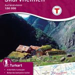
 Aurlandsdalen Nordeca 2565
 Nesbyen Nordeca 2573
 Skarvheimen Nordeca 2661
 Eidfjord Nordeca 2677
 Rauhelleren Nordeca 2727