Disclosure : This site contains affiliate links to products. We may receive a commission for purchases made through these links.
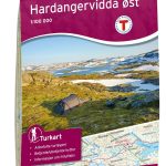
Hardangervidda East PhoneMaps Outdoor Map 113

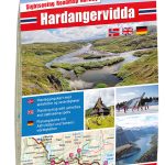
The Hardangervidda Ost hiking map, scale 1: 50,000, by Edition PhoneMaps, shows the eastern part of the Hardangervidda National Park.The hiking map includes marked hiking and biking trails as well as tourist and cycling information. The card is produced on an innovative ecological paper. The paper is nature friendly, recyclable, waterproof and tearproof, making it ideal for outdoor activities. The map is connected to the PhoneMaps app. It allows users to download detailed hiking and cycling maps from across Europe for free.

Related Products:
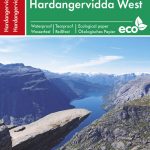 Hardangervidda West PhoneMaps Outdoor Map 114
 Lofoten PhoneMaps Outdoor Map 104
 Seychelles PhoneMaps Outdoor Map
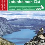 Jotunheimen East PhoneMaps Outdoor Map 109
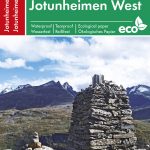 Jotunheimen West PhoneMaps Outdoor Map 110
 Hardangervidda East Nordeca 2556
 Hardangervidda Nordeca 3006
 Weinviertel East K+F Outdoor Map 19
 Taunus East – Grosser Feldberg – Kรถnigstein – Bad Homberg K+F Outdoor Map 33
Lake Constance East – Friedrichshafen – Lindau – Ravensburg – Rorschach K+F Outdoor Map 44
Taunus East – Grosser Feldberg – Kรถnigstein – Bad Homberg K+F Outdoor Map 33
Lake Constance East – Friedrichshafen – Lindau – Ravensburg – Rorschach K+F Outdoor Map 44
 Hardangervidda West Nordeca 2558
 Hardangervidda Nordeca Sightseeing Map 6008
 Hardangervidda
 Finland East Karttakeskus Outdoor Road Map
 Hardangervidda West Nordeca 2659
 Hardangervidda Nordeca Sightseeing Map 6028
 Wiener Hausberge K+F Outdoor Map 21
 Ordnance Survey Explorer Maps: Complete Set
 Bad Gastein K+F Outdoor Map 16
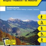 Bregenzerwald – Bregenz – Feldkirch – Gr. Walsertal K+F Outdoor Map 1
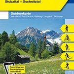 Innsbruck – Brenner – Stubaital – Gschnitztal K+F Outdoor Map 7
 Zillertal – Mayrhofen – Hintertux – Gerlospass K+F Outdoor Map 9
 Zell am See – Kaprun – Glemmtal – Unterpinzgau K+F Outdoor Map 11
 Dachstein – Ausseerlnad – Bad Goisern – Hallstatt K+F Outdoor Map 15
 Nationalpark Nockberge – Millstรคtter See – Spittal K+F Outdoor Map 18
 Wรถrthersee – Ossiacher See K+F Outdoor Map 17
 Vienna Woods / Wienerwald K+F Outdoor Map 20
 Tannheimer Tal – Fernpass – Unteres Lechtal – Reutte – Plansee K+F Outdoor Map 5
 Ischgl – Serfaus – Paznautal – Landeck K+F Outdoor Map 4
 Arlberg – St. Anton – Lech – Zรผrs – Oberes Lechtal – Verwallgruppe K+F Outdoor Map 3
 Alpenwelt Karwendel – Innsbruck – Achensee – Risstal K+F Outdoor Map 8
 Teutoburg Forest K+F Outdoor Map 45
 Montafon – Silvretta – Schruns – Gaschum – Bielerhรถhe K+F Outdoor Map 2
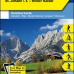 Kitzbรผhel – St. Johann in Tirol – Wilder Kaiser K+F Outdoor Map 10
 Tegernsee – Schliersee K+F Outdoor Map 5
Starnberger See – Ammersee K+F Outdoor Map 27
Tegernsee – Schliersee K+F Outdoor Map 5
Starnberger See – Ammersee K+F Outdoor Map 27
 Isle of Mull East – Craignure OS Explorer Map 375 (paper)
 Bradford & Huddersfield – East Calderdale OS Explorer Map 288 (waterproof)
 Greenwich and Gravesend – East End, Docklands OS Explorer Map 162 (paper)
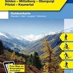 ร–tztal – Sรถlden – Mittelberg – Obergurgl – Pitztal – Kaunertal K+F Outdoor Map 6