Disclosure : This site contains affiliate links to products. We may receive a commission for purchases made through these links.
Harborne South 1901

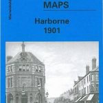
Harborne South in 1901 in a fascinating series of reproductions of old Ordnance Survey plans in the Alan Godfrey Editions, ideal for anyone interested in the history of their neighbourhood or family. The map covers the southern part of Harborne and the northern fringe of Northfield. Coverage stretches from Victoria Road southward to Weoley Park Farm and the northern tip of Selly Oak Park, and from Metchley Lane westward to Barnes Hill. Features include St Peter`s church, Harborne Hall, Mill Farm, Dudley Canal, California area, site of Weoley Castle, Metchley Grange, The Grove, Harborne House, Gravel Bank, Welsh House Farm, etc. On the reverse are street directory entries for Harborne Lane, Metchley Lane, Northfield Road, Old Church Road, St Mary`s Road, St Peter`s Road and Victoria Road. This title also includes Worcestershire sheet 5.15.About the Alan Godfrey Editions of the 25″ OS Series:Selected towns in Great Britain and Ireland are covered by maps showing the extent of urban development in the last decades of the 19th and early 20th century. The plans have been taken from the Ordnance Survey mapping and reprinted at about 15 inches to one mile (1:4,340). On the reverse most maps have historical notes and many also include extracts from contemporary directories. Most maps cover about one mile (1.6kms) north/south, one and a half miles (2.4kms) across; adjoining sheets can be combined to provide wider coverage.FOR MORE INFORMATION AND A COMPLETE LIST OF ALL AVAILABLE TITLES PLEASE CLICK ON THE SERIES LINK.

Related Products:
 Harborne 1901
 South Yardley and Hay Mills 1903
 South Harrow and Northolt Park 1935
Edgbaston 1901
South Harrow and Northolt Park 1935
Edgbaston 1901
 Sedgley South-East with Swan Village and West Coseley 1901
Barnsley South 1904
Sedgley South-East with Swan Village and West Coseley 1901
Barnsley South 1904
 Wolverhampton North West 1901
Rotherham South 1901
Selly Oak and Bournville 1903
Cradley South 1901
Wolverhampton North West 1901
Rotherham South 1901
Selly Oak and Bournville 1903
Cradley South 1901
 South Croydon 1895 – 14.14
 South Croydon 1895 – 159.2
 Walsall (SE) 1901 – 63.11
 Leeds South and South East 1906
 Alexandra Park and South Friern 1935
 Alexandra Park & South Friern 1894 – 6a
Leeds South and South East 1890 (Colour Edition)
Alexandra Park & South Friern 1894 – 6a
Leeds South and South East 1890 (Colour Edition)
 Alexandra Park & South Friern 1911 – 6b
Quinton 1902
Alexandra Park & South Friern 1911 – 6b
Quinton 1902
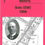 Sale South-West 1908
Northfield South 1903
Loughborough 1901
Sale South-West 1908
Northfield South 1903
Loughborough 1901
 Croydon East: Coombe Park & Addiscombe Road 1895 – 158
Gateacre 1904
Croydon East: Coombe Park & Addiscombe Road 1895 – 158
Gateacre 1904
 West Drayton South 1935
 Wickersley 1901
Trafford Park South 1937
Knutsford South 1908
Wickersley 1901
Trafford Park South 1937
Knutsford South 1908
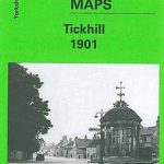 Tickhill 1901
Halifax: Mixenden and South Illingworth 1905
Tickhill 1901
Halifax: Mixenden and South Illingworth 1905
 Cambridge (North) 1901 – 40.14
 South Acton & Gunnersbury Park 1935 – 71.4
Willesden and Stonebridge Park 1936
Enfield (South) 1895 – 7.07a
Wollaston 1901 – 4.09
Halesowen (West) 1901 – 4.16
Colwyn Bay South West 1911
Farington South and Leyland North 1909
Donaghadee 1901
South Acton & Gunnersbury Park 1935 – 71.4
Willesden and Stonebridge Park 1936
Enfield (South) 1895 – 7.07a
Wollaston 1901 – 4.09
Halesowen (West) 1901 – 4.16
Colwyn Bay South West 1911
Farington South and Leyland North 1909
Donaghadee 1901
 Walton on the Hill 1906