Disclosure : This site contains affiliate links to products. We may receive a commission for purchases made through these links.
Hamilton Low Parks 1897

Hamilton Low Parks in 1897 in a fascinating series of reproductions of old Ordnance Survey plans in the Alan Godfrey Editions, ideal for anyone interested in the history of their neighbourhood or family. The map covers the northern part of Hamilton and is dominated by Hamilton Low Parks. In the south-western corner are Clyde Colliery, Hamilton Poorhouse and Infantry Barracks. Other features include much of Hamilton Race Course, Great North Avenue, Back Muir Plantation, Barmichael Plantation, Mausoleum, etc. On the reverse is a six inch to the mile map of the area in 1859, covering a wider area including Bothwell, Bothwellhaugh and Kirkfield.About the Alan Godfrey Editions of the 25″ OS Series:Selected towns in Great Britain and Ireland are covered by maps showing the extent of urban development in the last decades of the 19th and early 20th century. The plans have been taken from the Ordnance Survey mapping and reprinted at about 15 inches to one mile (1:4,340). On the reverse most maps have historical notes and many also include extracts from contemporary directories. Most maps cover about one mile (1.6kms) north/south, one and a half miles (2.4kms) across; adjoining sheets can be combined to provide wider coverage.FOR MORE INFORMATION AND A COMPLETE LIST OF ALL AVAILABLE TITLES PLEASE CLICK ON THE SERIES LINK.

Related Products:
 Hamilton 1896
Stonefield, Auchinraith & Burnbank 1897 – 11.15
Lenzie 1897
Hamilton 1896
Stonefield, Auchinraith & Burnbank 1897 – 11.15
Lenzie 1897
 Uddingston 1897 – 11.07
Timperley 1897
Craigendoran and Helensburgh East 1897
Durham City South 1897
Uddingston 1897 – 11.07
Timperley 1897
Craigendoran and Helensburgh East 1897
Durham City South 1897
 Hazel Grove 1897
Dumbarton 1897
Hazel Grove 1897
Dumbarton 1897
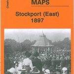 Stockport East 1897
Sacriston 1897
Barnard Castle 1897 – 52.04a
Stockport East 1897
Sacriston 1897
Barnard Castle 1897 – 52.04a
 Swansea 1897 – 24.05
Tow Law 1897
Whetstone 1897
Bothwell & Blantyre 1897 – 11.11
Swansea 1897 – 24.05
Tow Law 1897
Whetstone 1897
Bothwell & Blantyre 1897 – 11.11
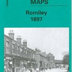 Romiley 1897
 St Albans South-West 1897
 Cheadle and Cheadle Heath 1897
Meadowfield 1897
Coatbridge 1897
Motherwell (East) 1897 – 12.14
Langley Moor and Brandon Colliery 1897
Port Sunlight and Bebington 1897
Cheadle and Cheadle Heath 1897
Meadowfield 1897
Coatbridge 1897
Motherwell (East) 1897 – 12.14
Langley Moor and Brandon Colliery 1897
Port Sunlight and Bebington 1897
 Swansea (North) 1897 – 24.01
East Barnet & Southgate 1897 – 7.09
Swansea (North) 1897 – 24.01
East Barnet & Southgate 1897 – 7.09
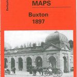 Buxton 1897 – 15.13
Coatdyke 1897 – 8.09
Parkhead 1897 – 6.16
Dun Laoghaire 1908
Motherwell 1910 – 12.13b
Motherwell 1896
Holytown & New Stevenston 1910 – 12.06
New Quay 1904
Buxton 1897 – 15.13
Coatdyke 1897 – 8.09
Parkhead 1897 – 6.16
Dun Laoghaire 1908
Motherwell 1910 – 12.13b
Motherwell 1896
Holytown & New Stevenston 1910 – 12.06
New Quay 1904
 Reeth and Grinton 1910
 South Norwood 1895
No Place, Beamish and West Pelton 1895
Pedmore 1921
Mouth of the Tyne 1895
South Norwood 1895
No Place, Beamish and West Pelton 1895
Pedmore 1921
Mouth of the Tyne 1895
 Great Driffield 1909