Disclosure : This site contains affiliate links to products. We may receive a commission for purchases made through these links.
Halesowen (West) 1901 – 4.16
Halesowen West in 1901 in a fascinating series of reproductions of old Ordnance Survey plans in the Alan Godfrey Editions, ideal for anyone interested in the history of their neighbourhood or family. The map covers the western part of Halesowen and part of Hasbury, including Lower Hasbury and the suburbs of Town`s End, Spring Hill and Short Cross. Features include St John the Baptist church, Otterbourne Court, Spring Villas, Grammar School, Newfield House, Hasbury Farm, Lower Hasbury, St Margaret`s Well, Sampson & Lion pub, Witley Colliery, Lutley Mill, Bassnage Farm, etc. On the reverse is a commercial directory of Halesowen in 1896. About the Alan Godfrey Editions of the 25″ OS Series:Selected towns in Great Britain and Ireland are covered by maps showing the extent of urban development in the last decades of the 19th and early 20th century. The plans have been taken from the Ordnance Survey mapping and reprinted at about 15 inches to one mile (1:4,340). On the reverse most maps have historical notes and many also include extracts from contemporary directories. Most maps cover about one mile (1.6kms) north/south, one and a half miles (2.4kms) across; adjoining sheets can be combined to provide wider coverage.FOR MORE INFORMATION AND A COMPLETE LIST OF ALL AVAILABLE TITLES PLEASE CLICK ON THE SERIES LINK.

Related Products:
 Halesowen (East) 1913 – 5.13b
 Wollaston 1901 – 4.09
Bangor West 1901
Wollaston 1901 – 4.09
Bangor West 1901
 Wickersley 1901
Shire Oak and Catshill 1901
Wickersley 1901
Shire Oak and Catshill 1901
 Dudley West 1901
Wolverhampton North West 1901
The Cheviot 1901-13 – 5
Dudley West 1901
Wolverhampton North West 1901
The Cheviot 1901-13 – 5
 Sedgley South-East with Swan Village and West Coseley 1901
Dundee West 1901
Bolton upon Dearne 1901
Horsehay and Dawley 1901
Harborne South 1901
Rotherham South 1901
Sedgley South-East with Swan Village and West Coseley 1901
Dundee West 1901
Bolton upon Dearne 1901
Horsehay and Dawley 1901
Harborne South 1901
Rotherham South 1901
 Bescot 1901
Sherborne 1901
Horsham, Crawley and St Leonards`s Forest 1901
Blandford Forum 1901
Bescot 1901
Sherborne 1901
Horsham, Crawley and St Leonards`s Forest 1901
Blandford Forum 1901
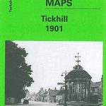 Tickhill 1901
Cradley South 1901
Kilnhurst 1901
Donaghadee 1901
Flodden Field & North Cheviots 1901 – 3
Tickhill 1901
Cradley South 1901
Kilnhurst 1901
Donaghadee 1901
Flodden Field & North Cheviots 1901 – 3
 Cambridge (North) 1901 – 40.14
Bridgnorth 1901
Stourport 1901
Selsey Bill, Bognor and Worthing 1901
Cambridge (North) 1901 – 40.14
Bridgnorth 1901
Stourport 1901
Selsey Bill, Bognor and Worthing 1901
 Walsall (SE) 1901 – 63.11
Wolverhampton (SW) 1901 – 62.10
Bridport 1901
Walsall (SE) 1901 – 63.11
Wolverhampton (SW) 1901 – 62.10
Bridport 1901
 Willenhall (NW) & Wednesfield 1901 – 62.08a
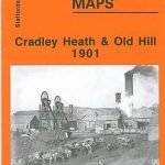 Cradley Heath and Old Hill 1901
Haslemere and District 1901
Cradley Heath and Old Hill 1901
Haslemere and District 1901
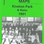 Kiveton Park and Wales 1901
Swinton 1901
Loughborough 1901
Bangor East 1901
Kiveton Park and Wales 1901
Swinton 1901
Loughborough 1901
Bangor East 1901
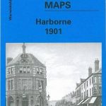 Harborne 1901
Alnwick & District 1901 – 6
Dorchester 1901
Harborne 1901
Alnwick & District 1901 – 6
Dorchester 1901