Disclosure : This site contains affiliate links to products. We may receive a commission for purchases made through these links.
Haida Gwaii / Queen Charlotte Islands – British Columbia Coast ITMB
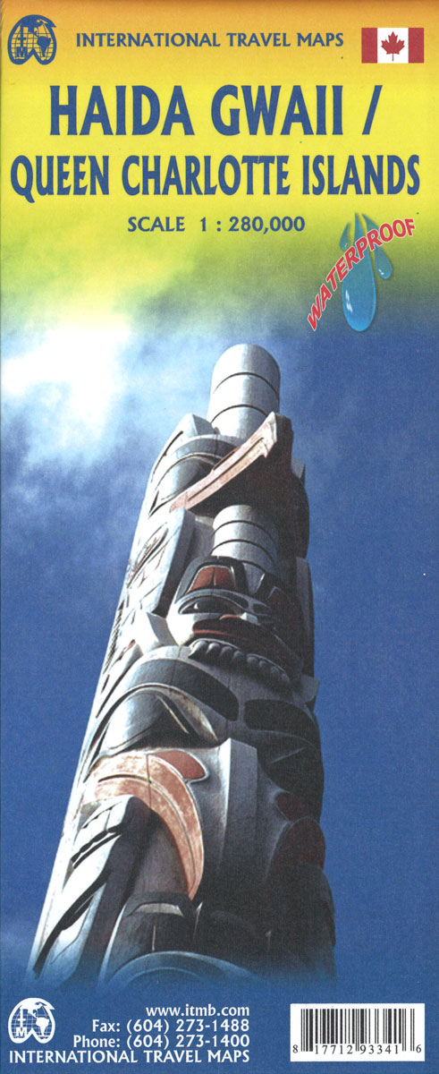
Queen Charlotte Islands / Haida Gwaii on a detailed map at 1:150,000 from the Vancouver-based ITMB, with contours at 150m intervals and spot heights. Protected areas and Indian Reserves are marked. The map shows local roads and tracks, indicating 4WD dry weather only routes and ferry connections. Symbols highlight camping and RV sites, picnic areas, view points, shipwrecks, lighthouses, etc. The map has latitude and longitude margin ticks at 30’ intervals.An enlargement at 1:66,666 covers the area of Queen Charlotte City and the Skidegate Islet. The map is surrounded notes on the island’s history, local Haida people, permit requirements, etc.To see other titles in this series please click on the series link.

Related Products:
 Queen Charlotte Islands / Haida Gwaii ITMB
 Haida Gwaii (Queen Charlotte) Islands
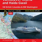 Vancouver Island and Haida Gwaii – SW British Columbia Back Road Atlas
 British Columbia South ITMB
 PAC202E Discovery Passage to Queen Charlotte Strait and West Coast of Vancouver Island, 2016
 Marlborough Sounds: Queen Charlotte Track
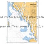
 CHS Chart 3811 – Harbours in Queen Charlotte Islands
 West Coast of Vancouver Island and Queen Charlotte Sound Charts
Charts for Haida Gwaii
West Coast of Vancouver Island and Queen Charlotte Sound Charts
Charts for Haida Gwaii
 PAC206E Hecate Strait, Dixon Entrance, Portland Inlet and Adjacent Waters and Haida Gwaii, 2015
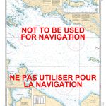
 CHS Chart 3744 – Queen Charlotte Sound
 PAC205E Inner Passage – Queen Charlotte Sound to Chatham Sound, 2002 – CHS Sailing Directions
 Admiralty Chart 4923 – Queen Charlotte Sound
 Admiralty Chart NZ6153 – Queen Charlotte Sound
 British Columbia ITMB Pocket Road Atlas
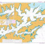
 CHS Chart 3002 – Queen Charlotte Sound to Dixon Entrance
 CHS Chart 3547 – Queen Charlotte Strait, Eastern Portion
 CHS Chart 3548 – Queen Charlotte Strait, Central Portion
 CHS Chart 3549 – Queen Charlotte Strait, Western Portion
 Virgin Islands (US and British) ITMB
 CHS Chart 3605 – Quatsino Sound to Queen Charlotte Strait
 NZ6153 Queen Charlotte Sound / Totaranui
 Admiralty Chart 4942 – Quatsino Sound to Queen Charlotte Strait
 CHS Chart 3001 – Vancouver Island, Juan de Fuca Strait to Queen Charlotte Sound
 Vol 7 Queen Charlotte Sound to Dixon Entrance 2019 – CHS Tide and Current Tables
 Sunshine Coast – British Columbia Southwest ITMB
 NP26 British Columbia Pilot Vol 2
Solomon Islands & South Pacific Ocean ITMB
NP26 British Columbia Pilot Vol 2
Solomon Islands & South Pacific Ocean ITMB
 Canada: ITMB Detailed Road Maps of British Columbia and the Canadian Rockies
 Whistler and Sea-to-Sky Highway ITMB
British Columbia SW & Washington State ITMB
Whistler and Sea-to-Sky Highway ITMB
British Columbia SW & Washington State ITMB
 Gulf Islands – Nanaimo and Islands ITMB
 British Columbia ITMB
 Southwest Alberta & Southeast British Columbia Gem Trek
 Charlotte`s Web
 Algonquin Park ITMB
 British Columbia – Alberta MapArt
 British Columbia – Alberta FastTrack
 Charlotte NC Rand McNally
 Southern British Columbia & Alberta ITMB