Disclosure : This site contains affiliate links to products. We may receive a commission for purchases made through these links.
Haida Gwaii (Queen Charlotte) Islands
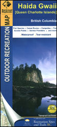
Haida Gwaii (Queen Charlotte) Islands at 1:200,000 on a large, contoured map from Mussio Ventures, printed on light, waterproof and tear-resistant plastic paper, with notes on recreational activities and sites, etc.The map is double-sided, covering on one side Graham Island, with Moresby and the southern islands on the reverse. Skidegate Inlet and the area around Sandspit and Queen Charlotte are shown on an enlargement at 1:100,000. Contours are at 20m interval with additional relief shading. Very detailed grading of the road network includes classifications for 2WD or 4WD industry roads. Symbols indicate various types of campsites and caravan parks, trail heads, wildlife viewing locations, etc. Larger lakes are notated to show what species of fish can be found there. The map has a UTM grid. Each side has a separate extensive index. Also included are lists of activities available in the local provincial parks and recreational sites, plus advertisements for various local services, cross-referenced to their locations on the map.

Related Products:
 Queen Charlotte Islands / Haida Gwaii ITMB
 Haida Gwaii / Queen Charlotte Islands – British Columbia Coast ITMB
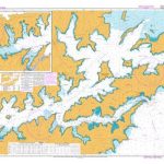
 CHS Chart 3811 – Harbours in Queen Charlotte Islands
 Marlborough Sounds: Queen Charlotte Track
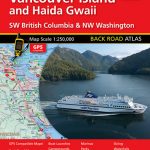 Vancouver Island and Haida Gwaii – SW British Columbia Back Road Atlas
 PAC202E Discovery Passage to Queen Charlotte Strait and West Coast of Vancouver Island, 2016
 Admiralty Chart 4923 – Queen Charlotte Sound
 Admiralty Chart NZ6153 – Queen Charlotte Sound
 CHS Chart 3744 – Queen Charlotte Sound
 PAC205E Inner Passage – Queen Charlotte Sound to Chatham Sound, 2002 – CHS Sailing Directions
 Admiralty Chart 4942 – Quatsino Sound to Queen Charlotte Strait
 CHS Chart 3002 – Queen Charlotte Sound to Dixon Entrance
 CHS Chart 3547 – Queen Charlotte Strait, Eastern Portion
 CHS Chart 3548 – Queen Charlotte Strait, Central Portion
 CHS Chart 3549 – Queen Charlotte Strait, Western Portion
 CHS Chart 3605 – Quatsino Sound to Queen Charlotte Strait
 NZ6153 Queen Charlotte Sound / Totaranui
 West Coast of Vancouver Island and Queen Charlotte Sound Charts
 CHS Chart 3001 – Vancouver Island, Juan de Fuca Strait to Queen Charlotte Sound
 Vol 7 Queen Charlotte Sound to Dixon Entrance 2019 – CHS Tide and Current Tables
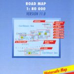 Virgin Islands (US and British)
 Orkney – Shetland Islands Leisure and Tourist Map
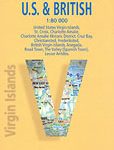
 Virgin Islands (US and British) ITMB
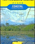 Marco Island – Ten Thousand Islands FL
 Falkland Islands Explorer
 Virgin Islands Borch
 NGA Chart 15023 – Queen Elizabeth Islands – Southern Part
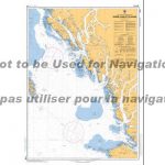
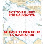
Charts for Haida Gwaii
NGA Chart 15023 – Queen Elizabeth Islands – Southern Part
Charts for Haida Gwaii
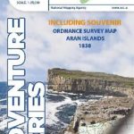 The Aran Islands OSI Adventure Map – including Souvenir OS Map Aran Islands 1838
 PAC206E Hecate Strait, Dixon Entrance, Portland Inlet and Adjacent Waters and Haida Gwaii, 2015
 Charlotte NC Rand McNally
 On The Trail of Queen Victoria in the Highlands
 Queen Victoria and the Discovery of the French Riviera
 Ecuador – Galapagos Islands Reise Know-How
 Islay North: Port Askaig, Bridgend & Port Charlotte OS Explorer Map 353 (paper)
 Islay North – Port Askaig, Bridgend & Port Charlotte OS Explorer Active Map 353 (waterproof)
 Charlotte Gray
 Queen: A Royal Celebration of the Life and Family of Queen Elizabeth II, on Her 90th Birthday
 Providenciales / Provo – Turks & Caicos Islands
 England & Wales Island Bagging: A guide to adventures on the islands of England, Wales, the Channel Islands & the Isle of Man