Disclosure : This site contains affiliate links to products. We may receive a commission for purchases made through these links.
Gunnislake North 1905
Gunnislake North in 1905 in a fascinating series of reproductions of old Ordnance Survey plans in the Alan Godfrey Editions, ideal for anyone interested in the history of their neighbourhood or family. Gunnislake is covered by two maps. This title covers the northern part of the village, from St Anne`s church northward, including the adjacent hamlets of Middle Dimson, Lower Dimson and North Dimson. Coverage extends eastward to Hatchwood, Luscombedown Plantation and Gulworthy Farm (which is split by the extreme right margin). Northward are Hangingcliff Wood and part of Blanchdown Wood. Features include the disused Plymouth Works, disused South Bedford mine, Gunnislake Clitters Mine (at left margin), Bedford United Mine, Hawkmoor Mine, Watson`s Mine, Bedford United Mine, several old shafts, also the route of an already abandoned railway to Watson`s Mine and other workings. On the reverse is a 1910 directory.About the Alan Godfrey Editions of the 25″ OS SeriesSelected towns in Great Britain and Ireland are covered by maps showing the extent of urban development in the last decades of the 19th and early 20th century. The plans have been taken from the Ordnance Survey mapping and reprinted at about 15 inches to one mile (1:4,340). On the reverse most maps have historical notes and many also include extracts from contemporary directories. Most maps cover about one mile (1.6kms) north/south, one and a half miles (2.4kms) across; adjoining sheets can be combined to provide wider coverage.FOR MORE INFORMATION AND A COMPLETE LIST OF ALL AVAILABLE TITLES PLEASE CLICK ON THE SERIES LINK.

Related Products:
 Gunnislake South and Albaston 1905
Norwich (North) 1905 – 63.11
Gunnislake South and Albaston 1905
Norwich (North) 1905 – 63.11
 Sevenoaks North and Riverhead 1907
Boscastle 1905
Sevenoaks North and Riverhead 1907
Boscastle 1905
 Halifax: Mixenden and South Illingworth 1905
 Tong 1905
Farington South and Leyland North 1909
Knutsford North 1908
Tong 1905
Farington South and Leyland North 1909
Knutsford North 1908
 Wirksworth 1920
Tavistock 1905
Ivybridge 1905
Hurst and North Ashton 1906
Wirksworth 1920
Tavistock 1905
Ivybridge 1905
Hurst and North Ashton 1906
 Bromley North and Sundridge Park 1895
Looe 1905
Carlisle North-East 1924
Bromley North and Sundridge Park 1895
Looe 1905
Carlisle North-East 1924
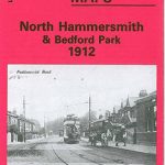 North Hammersmith and Bedford Park 1912
 North Hammersmith & Bedford Park 1893 – 72.2
 Heckmondwike 1905
Willenhall North East 1885
North Chorley 1909 – 77.08
Heckmondwike 1905
Willenhall North East 1885
North Chorley 1909 – 77.08
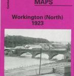 Workington North 1923
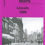 City of Lincoln 1905 – 70.07a
Darlington North 1896
City of Lincoln 1905 – 70.07a
Darlington North 1896
 Huddersfield South 1905
Old Trafford 1905
Colwyn Bay North 1911
Wrexham North 1909
Motherwell (North) 1939 – 12.09
South Bank and Grangetown North 1927
Huddersfield South 1905
Old Trafford 1905
Colwyn Bay North 1911
Wrexham North 1909
Motherwell (North) 1939 – 12.09
South Bank and Grangetown North 1927
 Bury North 1908
Bedford 1924 – 11.16b
Bury North 1908
Bedford 1924 – 11.16b
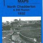 Chadderton North 1932
Carshalton & North Wallington 1910 – 13.12
Chadderton North 1932
Carshalton & North Wallington 1910 – 13.12
 Evesham North 1903
Wakefield West 1905
Evesham North 1903
Wakefield West 1905
 Warwick North 1923
 Goole 1905
Camelford 1905
Halifax Ovenden Cross 1905
Goole 1905
Camelford 1905
Halifax Ovenden Cross 1905
 Bradford North 1906