Disclosure : This site contains affiliate links to products. We may receive a commission for purchases made through these links.
Guam Guide & Dive Map
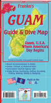
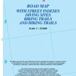
Guam Guide and Dive Map from Franko`s Maps printed on light, waterproof and tear-resistant synthetic paper, with a wealth of information for various recreational activities, historical sights, etc, plus a map of Micronesia.On one side is a map showing the whole of Guam with enlargements on the reverse presenting Apra Harbour and Tumon Bay in greater detail. All are extensively annotated with tourist facilities and recreational sites: hiking, mountain biking, kayaking, surfing, etc, with numerous diving sites shown in the island’s coastal waters. Also marked are various historical locations, including those connected with the Guam’s history in World War II. Extensive accompanying notes provide more information, including details of the diving sites (depth in feet and metres of numerous reefs, walls, ledges, etc) and contact details for accommodation.The map includes a street map of the centre of Agana (Hagatna) showing a 3-mile heritage trail. Also provided is an overview map of Micronesia from Palau to Kiribati, with insets showing in greater detail: Palau Islands, Yap, Tinian, Saipan, Rota, Chuuk (Truk Islands, Pohnpei Islands, Kosrae, plus the Majuro and Arno Atolls of the Marshall Islands.The map is printed on light, waterproof and tear-resistant synthetic paper and is decorated with lovely colour drawings of numerous species of fish found around Micronesia.

Related Products:
 US Virgin Islands Adventure and Dive Map/Guide
 Curaรงao Dive Map/Guide
 Cayman Islands Guide & Dive Map
 Chuuk (Truk) Lagoon Dive & Wreck Map – Operation Hailstone Historical Map
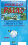 Palau Franko`s Adventure & Dive Map-Guide
Florida Keys Adventure & Dive Map-Guide
Palau Franko`s Adventure & Dive Map-Guide
Florida Keys Adventure & Dive Map-Guide
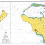
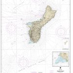 NOAA Chart 81048 – Island of Guam’”Territory of Guam – Cocos Lagoon
Cozumel “Island of Peace” Franko`s Dive & Guide Map
NOAA Chart 81048 – Island of Guam’”Territory of Guam – Cocos Lagoon
Cozumel “Island of Peace” Franko`s Dive & Guide Map
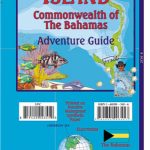
 Great Abaco – Bahamas Franko Adventure & Dive Map-Guide
 British Virgin Islands Franko`s Map-Guide
Belize Dive Map
British Virgin Islands Franko`s Map-Guide
Belize Dive Map
 UK Dive Guide: Diving Guide to England, Ireland, Scotland and Wales
 The Cayman Islands: Dive Guide
 The Antarctic Dive Guide
 Eleuthera Island – Bahamas Adventure Map-Guide
 Diving in Indonesia: The Ultimate Guide to the World`s Best Dive Spots: Bali, Komato, Sulawesi, Papua, and More
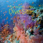 The World`s Great Dive Sites
 Bahamas ITMB
 NOAA Chart 81054 – Apra Harbor’”Territory of Guam
 Admiralty Chart 1109 – Guam
 Curaรงao
 Gulf Islands – Nanaimo and Islands ITMB
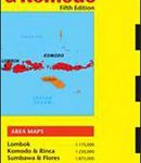 Lombok & Komodo Periplus Travel Map
World Awesome Maps Dive Wall Map
Lombok & Komodo Periplus Travel Map
World Awesome Maps Dive Wall Map
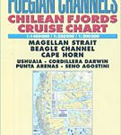 Patagonian & Fuegian Channels – Chilean Fjords Cruise Chart
 Trinidad and Tobago Dive Guide
 Japan ITMB
 Beijing & the Great Wall ITMB
 Diving in Southeast Asia: A Guide to the Best Sites in Indonesia, Malaysia, the Philippines and Thailand
 Dive Atlas of the World: An Illustrated Reference to the Best Sites
 Diving Southeast Asia Footprint Guide
 Underwater Guide to Seychelles
 Tennessee NGS Guide Map
 Virgin Islands (US and British) ITMB
 O`ahu Island and Honolulu
 St. Kitts and Nevis
 Hawaii NGS Adventure Map 3111
 Underwater Guide to Seychelles (2nd edition)
 Peninsular Malaysia Periplus Travel Map
 Greater Yellowstone & Grand Teton Benchnark Maps Recreation Atlas & Guide