Disclosure : This site contains affiliate links to products. We may receive a commission for purchases made through these links.
Guadeloupe – St. Martin / Sint Maarten – St. Barthelemy IGN 84971
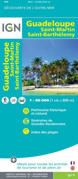
This tourist and road map of Guadeloupe allows you to discover this exotic destination. A rich range of tourist information (local markets, crafts, interesting sites) and information on outdoor activities (hiking, surfing, scuba diving, paragliding, horse riding) are at your disposal to help you appreciate the island.
Related Products:
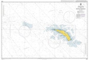
 Admiralty Chart 2079 – Ports and Anchorages in Anguilla-Sint Maarten (Saint Martin) and Saint Barthelemy
 Saint-Martin / Sint Maarten – St.Barthรฉlemy IGN 4606GT
 Saint Martin / Sint Maarten
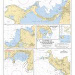 SHOM Chart 7472 – Ports et mouillages de Saint-Martin (Sint Maarten) et de Saint-Barthรฉlemy
 Fodor`s In Focus St. Maarten/St. Martin, St. Barth & Anguilla
 Sint Maarten Flag – 1/2 yard – Printed
 A24 Anguilla, St Martin and St Barthelemy
 Teutoburg Forest K+F Outdoor Map 45
 Tegernsee – Schliersee K+F Outdoor Map 5
 Starnberger See – Ammersee K+F Outdoor Map 27
 Pfaffenwinkel – Peissenberg – Weilheim K+F Outdoor Map 28
 Bad Tรถlz – Lenggries – Isarwinkel K+F Outdoor Map 4
 Frรคnkische Schweiz K+F Outdoor Map 37
 Hochspessart – Aschaffenburg – Lohr – Wertheim K+F Outdoor Map 50
 Hanover – Steinhuder Meer – Deister K+F Outdoor Map 57
 Black Forest – Pforzheim – Baden-Baden K+F Outdoor Map 52
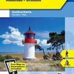 Rรผgen – Hiddensee – Stralsund K+F Outdoor 14
 Berchtesgaden ‘“ Bad Reichenhall ‘“ Kรถnigsee K+F Outdoor Map 8
 Ordnance Survey Explorer Maps: Complete Set
 Rhรถn – Hohe Rhรถn – Wasserkuppe – Milseburg K+F Outdoor Map 23
 Bavarian Forest NP – Bodenmais – Zwiesel – Grafenau K+F Outdoor Map 54
 Obere Donau – Baar – Donaueschingen K+F Outdoor Map 53
 Lake Constance West – Konstanz – Radolfzell K+F Outdoor Map 43
 Germany: Kรผmmerly+Frey Hiking and Recreational Maps
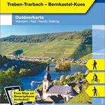 Central Moselle Valley – Trier to Zell K+F Outdoor Map 22
 Lower Rhine – Kleve – Wesel – Xanten K+F Outdoor Map 61
 Rheingau – West Taunus – Rรผdesheim – Wiesbaden K+F Outdoor Map 51
 Feldberg – Upper Black Forest – Titisee K+F Outdoor Map 26
 Altmรผhltal – Eichstรคtt – Beilngries – Kelheim K+F Outdoor Map 38
 Franconian Switzerland – Wiesenttal – Pottenstein K+F Outdoor Map 37
 Freiburg im Breisgau – Kaiserstuhl – Glottertal – Schaunisland K+F Outdoor Map 25
 Eifel National Park – Ahrtal K+F Outdoor Map 19
 Taunus East – Grosser Feldberg – Kรถnigstein – Bad Homberg K+F Outdoor Map 33
 Brocken – Oberharz – Harzquerbahn – NP Harz K+F Outdoor Map 17
 High Eifel – Vulkaneifel – Nรผrburgring – Daun – Gerolstein K+F Outdoor Map 20
 Lake Constance East – Friedrichshafen – Lindau – Ravensburg – Rorschach K+F Outdoor Map 44
 Oberstaufen – Westallgรคu – Adelegg – Lindenberg – Isny – Wangen K+F Outdoor Map 55
 Frรคnkisches Weinland – Wรผrzburg – Kitzingen – Ochsenfurt – Volkach K+F Outdoor Map 56
 Lower Moselle – Cochem to Koblenz – Mayen – Burg Eitz K+F Outdoor Map 21
 Kempten – Allgau – Immenstadt – Bad Grรถnenbach K+F Outdoor Map 46


