Disclosure : This site contains affiliate links to products. We may receive a commission for purchases made through these links.
Grigne Resegone – Valsassina Geo4Map 301

Related Products:
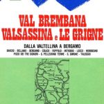 Val Brembana – Valsassina – Le Grigne: Lecco – Bergamo 50K IGC Map No. 22
 Le Grigne
 Val Grande Geo4Map 14
 Val Vigezzo Geo4Map 5
 Val Formazza – Val Bavona – Val Maggia Geo4Map 11 SUPERCEDED
 Valle di Bognanco – NP Alpe Veglia Geo4Map 8
Valle Anzasca – Vanzone – Piedimulera Geo4Map 6
Alto Verbano – Val Grande – Cannobio Geo4Map 15
Valle di Bognanco – NP Alpe Veglia Geo4Map 8
Valle Anzasca – Vanzone – Piedimulera Geo4Map 6
Alto Verbano – Val Grande – Cannobio Geo4Map 15
 Lago Maggiore – Luino – Val Veddasca Geo4Map 305
Mischabel – Saas Fee – Grรคchen – Tรคsch Geo4Map 22
Valle Anzasca – Monte Rosa – Macugnaga Geo4Map 5
Lago Maggiore – Luino – Val Veddasca Geo4Map 305
Mischabel – Saas Fee – Grรคchen – Tรคsch Geo4Map 22
Valle Anzasca – Monte Rosa – Macugnaga Geo4Map 5
 Valsesia – Val Mastallone – Boccioleto – Rossa – Varallo Geo4Map 3
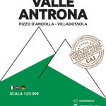 Valle Antrona – Pizzo d`Andolla – Villadossola Geo4Map 7
Cinque Terre – Golfo della Spezia Geo4Map 21
Valle Antrona – Pizzo d`Andolla – Villadossola Geo4Map 7
Cinque Terre – Golfo della Spezia Geo4Map 21
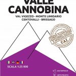 Valle Cannobina – Val Vigezzo – Monte Limidario Geo4Map 13
Valle del Ticino – Arona – Legnano – Magenta Geo4Map 1
Valle del Ticino – Abbiategrasso – Bereguardo – Pavia Geo4Map 2
Cervino / Matterhorn – Zermatt – Breuil Cervinia Geo4Map 23
Valle Cannobina – Val Vigezzo – Monte Limidario Geo4Map 13
Valle del Ticino – Arona – Legnano – Magenta Geo4Map 1
Valle del Ticino – Abbiategrasso – Bereguardo – Pavia Geo4Map 2
Cervino / Matterhorn – Zermatt – Breuil Cervinia Geo4Map 23
 Val Strona – Valli Dell`Ossola – Cusio – Valsesia Geo4Map 16
Valle del Ticino – Novara – Lago d`Orta – Stresa Geo4Map 3
Alpe Devero – Val Formazza – Binntal – Valle del Goms Geo4Map 10
Alpe Veglia – Val Divedro – Bugliaga – Monte Cistella Geo4Map 9
Val Strona – Valli Dell`Ossola – Cusio – Valsesia Geo4Map 16
Valle del Ticino – Novara – Lago d`Orta – Stresa Geo4Map 3
Alpe Devero – Val Formazza – Binntal – Valle del Goms Geo4Map 10
Alpe Veglia – Val Divedro – Bugliaga – Monte Cistella Geo4Map 9
 Valsesia – Varallo – Borgosesia – Monte Fenera – Cellio – Postua Geo4Map 2
Valsesia – Riva Valdobbia – Campertogno – Mollia – Rassa – Scopelllo Geo4Map 1
Lago di Varese – Laveno – Campo dei Fiori – Porto Ceresio Geo4Map 304
Parchi Senza Confine – Spina Verde – Parco del Penz – Gole della Breggia Geo4Map
Geo4Map – Hiking 25K Maps
Valsesia – Varallo – Borgosesia – Monte Fenera – Cellio – Postua Geo4Map 2
Valsesia – Riva Valdobbia – Campertogno – Mollia – Rassa – Scopelllo Geo4Map 1
Lago di Varese – Laveno – Campo dei Fiori – Porto Ceresio Geo4Map 304
Parchi Senza Confine – Spina Verde – Parco del Penz – Gole della Breggia Geo4Map
Geo4Map – Hiking 25K Maps
 Valsesia – Monte Rosa – Alagna Valsesia – Rima San Giuseppe – Carcoforo Geo4Map 4
 Geo4Map – Winter Sports 25K Maps
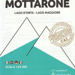 Mottarone – Lago d`Orta – Lago Maggiore Geo4Map 17
Le Colline del “Boca” – Boca – Borgomanero – Golasecca Geo4Map 18
Mottarone – Lago d`Orta – Lago Maggiore Geo4Map 17
Le Colline del “Boca” – Boca – Borgomanero – Golasecca Geo4Map 18
 Valle Isorno – Valle Antigorgio – Val Vigezzo – Valle Maggia Geo4Map 12