Disclosure : This site contains affiliate links to products. We may receive a commission for purchases made through these links.
Greenland Basal Topography BedMachine v3
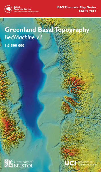
This double-sided geophysical and glaciological map shows the basal topography of Greenland and surrounding seabed. The topography of the subglacial landscape under the Greenland Icesheet was modelled using a mixture of radio echo-sounding and a glaciological model (BEDMACHINE 2) and is presented in a similar colour scheme to the Antarctic BEDMAP2. The map is a result of a collaboration between BAS and Bristol University, based on recently released data from a joint project between Bristol University and the University of Irvine California. – Side 1 shows a detailed map, in plan view, and includes important names, coastline and the zero metre contour. – Side 2 presents a 3D view of the dataset, highlighting some of the important and interesting features and gives further details of how the surface was constructed.

Related Products:
 Greenland Basal Topography BedMachine v3 Wall Map
 Greenland Reise Know-How
 Greenland : Greenland Tourism Hiking Maps
 BEDMAP2 Bedrock Topography of Antarctica BAS
 BEDMAP2 Bedrock Topography of Antarctica BAS Wall Map
 Crossing California: A Cultural Topography of a Land of Wonder and Weirdness
 Greenland Wall Map
 Greenland: Saga 500K Maps of Northern Greenland
 Greenland & North Pole ITMB
 California Reise Know-How
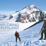 Exploring Greenland
 Greenland and the European Arctic BAS
 California Insight Travel Map
 San Francisco & Northern California ITMB
 Germany Topography and Physical Map
Greenland and the European Arctic BAS Wall Map
Germany Topography and Physical Map
Greenland and the European Arctic BAS Wall Map
 Greenland Red Set 1-4
 Greenland Yellow Set 9-12
 Greenland Orange Set 5-8
Greenland Green Set 13-16
Greenland Blue Set 17-20
Greenland Orange Set 5-8
Greenland Green Set 13-16
Greenland Blue Set 17-20
 1000 Greenland Westcoast
 2000 Greenland Eastcoast
South-Western Greenland Special Map
2000 Greenland Eastcoast
South-Western Greenland Special Map
 New York City – Manhattan Michelin City Plan and Index
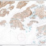
 Chart G – Greenland with Surrounding Waters
 1130 Greenland Westcoast – Frederiksdal
 1131 Greenland Westcoast – Nanortalik
 1132 Greenland Westcoast – Julianehab
1145 Greenland Westcoast – Kobberminebugt
1132 Greenland Westcoast – Julianehab
1145 Greenland Westcoast – Kobberminebugt
 1230 Greenland Westcoast – Frederikshab
 1530 Greenland Westcoast – Egedesminde
 Old City of Jerusalem Map
 NP286 (5) Pilot Services (North America, Canada and Greenland) 2020/21
 NP286 (5) Pilot Services (North America, Canada and Greenland) 2021/22
 2500 Greenland Eastcoast – Kap Garde to Scoresbysund
 1500 Greenland Westcoast – Rifkol to Hareo
 1113 Greenland Westcoast – Igdlukasik to Sydproven
 1511 Greenland Westcoast – Egedesminde to Godhavn
 1231 Greenland Westcoast – Qeqertarsuatsiaat (Fiskenaesset)