Disclosure : This site contains affiliate links to products. We may receive a commission for purchases made through these links.
Greece: Terrain Editions 150K Road Maps of Crete

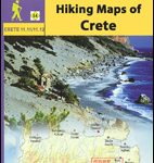
Crete on four road maps at 1:150,000 from the Athens-based Terrain Editions, highlighting scenic routes, campsites, archaeological remains and other places of interest, plus on the reverse a town centre street plan of the provincial capital, also with tourist information.Maps in this series present Creteโ€s topography by satellite-based relief shading, with spot heights for selected peaks. Road network indicates dirt roads and shows driving distances on main and on selected secondary routes. Scenic roads are prominently highlighted, as are locations of particular interest. Also marked are campsites, mountain refuges, archaeological sites, castles and monasteries, etc. All place names are in both Greek and Latin alphabets. The maps have a UTM grid, plus latitude and longitude crosshairs at 4โ€. Map legend includes English. On the reverse each title has a city centre street plan of its main town, indicating important buildings and facilities, including selected hotels, museums, banks, etc. One way streets are marked, also car parks, petrol stations and car repairs workshops. Main streets are in both Greek and Latin alphabet; smaller streets in Greek only.


