Disclosure : This site contains affiliate links to products. We may receive a commission for purchases made through these links.
Greece: Terrain Editions 100K Touring Maps of Crete
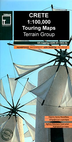
Crete at 1:100,000 on three contoured maps from Terrain Editions printed on light, waterproof and tear-resistant plastic paper. Each title is indexed and includes large street plan(s) of main town(s).The maps have contours at 100m intervals, enhanced by relief shading with spot heights and plenty of names of topographic features such as peaks, mountain ranges, etc. All place names are in both Greek and Latin alphabet.Road network differentiates between smooth and rough surface local roads, shows driving distances on most local roads, and indicates locations of petrol stations and tyre repair workshops. Scenic routes are highlighted. Ferry connections, both along Creteโ€s southern coast and with the rest of Greece, are also marked. For outdoor activities the maps show selected local footpaths, including the course of E4 long-distance trail, climbing crags, canyoning routes and scuba-diving centres. A range of symbols highlight other places of interest campsites, mountain refuges, archaeological sites, monasteries, etc. The maps have a 5km UTM grid for GPS. The index shows names of towns and villages in both scripts and includes separate lists of monasteries and archaeological sites.On the reverse is a street plan of the main town in the region, highlighting places of interest, various facilities and selected accommodation. Names of larger streets are in both alphabets; smaller streets are in Greek only.Map legends for both the main map and the street plan include English.

Related Products:
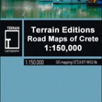 Greece: Terrain Editions 150K Road Maps of Crete
 Greece: Anavasi 100K Touring Maps of Crete
 Eastern Crete Terrain Editions 450
 Western Crete Terrain Editions 448
 Central Crete Terrain Editions 449
 Crete: Lasithi Prefecture 150K Terrain Editions Map
 Crete: Chania Prefecture 150K Terrain Editions Map
 Crete: Rethymno Prefecture 150K Terrain Editions Map
 Crere: Heraklion Prefecture 150K Terrain Editions Map
 Crete Terrain Editions Regional Map 7
 Chalkidiki / Halkidiki – Thessaloniki Street Plan Terrain Editions 412
 Greece: Terrain Editions Maps of the Greek Islands
 Greece: Anavasi Touring Maps of the Mainland and Peloponnese
 Greece: Terrain Editions Maps for Hiking and Recreational Pursuits
 Central Macedonia Terrain Editions Regional Map 2
 Epirus and Western Macedonia Terrain Editions Regional Map 3
 Thrace and Eastern Macedonia Terrain Editions Regional Map 1
 Greece Terrain Editions
 Zakynthos Terrain Editions 355
 Mt Athos Terrain Editions 209
 Evia / Euboea Terrain Editions
 Greece: Attika and Central Greece Road Atlas
 Kalymnos Terrain Editions 337
 Spetses Terrain Editions 360
 France: IGN 350K Touring Maps (2016 editions)
 Greece: Anavasi Hiking Maps of Crete
 Chios Terrain Editions 328
 Egina / Aegina Orama Editions 338
 Hydra Terrain Editions 359
 Kea / Tzia Terrain Editions 301
 Kythnos Terrain Editions 302
 Anafi Terrain Editions 318
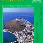
 Astypalaea / Astypalaia Terrain Editions 330
Andros Terrain Editions 307
Astypalaea / Astypalaia Terrain Editions 330
Andros Terrain Editions 307
 Astypalea / Astypalaia Orama Editions 322
 Ios Terrain Editions 315
 Spain: Reise Know-How Walking and Touring Maps of Mallorca
 Alonissos Terrain Editions 321
 Corfu Orama Editions 302