Disclosure : This site contains affiliate links to products. We may receive a commission for purchases made through these links.
Greece Terrain Editions

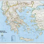
Greece at 1:650,000 on a double-sided map from the Terrain Editions, printed on light, waterproof and tear-resistant synthetic paper and with a separate index booklet listing localities in both Greek and Latin alphabets and providing a distance table.The map divides the country north/south, with Athens included on both with the mainland and with the Peloponnese, Crete, the Cyclades and the Dodecanese islands. Road network shows motorways with toll stations and rest areas, clearly distinguishes between paved and unsurfaced roads, indicates distances on main routes, and highlights scenic roads. Railway lines and ferry routes are includes and local airports are marked. Symbols show campsites and mountain refuges, archaeological and other interesting sites, etc. Topography is presented by light relief shading, with spot heights and highlighting for national parks. All place names are in Greek and Latin alphabets. The map has a UTM grid, plus margin ticks and crosshairs for latitude and longitude at 30’ intervals. Map legend includes English.

Related Products:
 Greece: Terrain Editions 100K Touring Maps of Crete
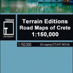 Greece: Terrain Editions 150K Road Maps of Crete
 Central Macedonia Terrain Editions Regional Map 2
 Greece: Terrain Editions Maps for Hiking and Recreational Pursuits
 Epirus and Western Macedonia Terrain Editions Regional Map 3
 Thrace and Eastern Macedonia Terrain Editions Regional Map 1
 Eastern Crete Terrain Editions 450
 Central Crete Terrain Editions 449
 Western Crete Terrain Editions 448
 Greece F&B
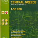 Greece: Attika and Central Greece Road Atlas
 Crete: Rethymno Prefecture 150K Terrain Editions Map
 Cyclades Terrain Editions Regional Map 8
 Crere: Heraklion Prefecture 150K Terrain Editions Map
 Greece Anavasi Road Map
 Crete Terrain Editions Regional Map 7
 Crete: Lasithi Prefecture 150K Terrain Editions Map
 Crete: Chania Prefecture 150K Terrain Editions Map
 Evia / Euboea Terrain Editions
 Chalkidiki / Halkidiki – Thessaloniki Street Plan Terrain Editions 412
 Greece: Terrain Editions Maps of the Greek Islands
 Greece: Anavasi 200K/250K Road Maps
 Zakynthos Terrain Editions 355
 Mt Athos Terrain Editions 209
 Central Greece – Thessaly – Epirus Anavasi Regional Map R3
 Greece ITMB
 Kalymnos Terrain Editions 337
 Kythira Terrain Editions 346
 Kea / Tzia Terrain Editions 301
 Anafi Terrain Editions 318
 Greece NGS Classic Wall Map PAPER
 Kos Terrain Editions Map 338
 Ios Terrain Editions 315
 Spetses Terrain Editions 360
 Fourni Terrain Editions 333
 Karpathos – Kasos Terrain Editions 345
 Kythnos Terrain Editions 302
 Santorini Terrain Editions 313
 Hydra Terrain Editions 359