Disclosure : This site contains affiliate links to products. We may receive a commission for purchases made through these links.
Great Malvern East 1926
Great Malvern East 1926 in a fascinating series of reproductions of old Ordnance Survey plans in the Alan Godfrey Editions, ideal for anyone interested in the history of their neighbourhood or family. The map covers the eastern part of Great Malvern, extending from the Priory Gardens eastward to Sherrard`s Green, and from St James`s Road southward to Court Road. Features include railway with station, Priory Gardens, Council House, Hatley St George, Swan Pool, Davenham, Mowbray House and other large houses, Girls College, Christ Church, Baths, Tomatoland, Cemetery, Chase Estate, Pickersleigh, Pound Bank, Court Farm, Old Elm Gospel Hall, Sherrad`s Green, Moat Court, etc. On the reverse is a selection of street directory entries, including Avenue Road, Barnards Green, Chase – Lower and Upper Roads and Court Road. About the Alan Godfrey Editions of the 25″ OS Series:Selected towns in Great Britain and Ireland are covered by maps showing the extent of urban development in the last decades of the 19th and early 20th century. The plans have been taken from the Ordnance Survey mapping and reprinted at about 15 inches to one mile (1:4,340). On the reverse most maps have historical notes and many also include extracts from contemporary directories. Most maps cover about one mile (1.6kms) north/south, one and a half miles (2.4kms) across; adjoining sheets can be combined to provide wider coverage.FOR MORE INFORMATION AND A COMPLETE LIST OF ALL AVAILABLE TITLES PLEASE CLICK ON THE SERIES LINK.

Related Products:
 Great Malvern and West Malvern 1926
Malvern Link 1926
Malvern: The Wyche 1926
Malvern Wells 1903
Great Malvern and West Malvern 1926
Malvern Link 1926
Malvern: The Wyche 1926
Malvern Wells 1903
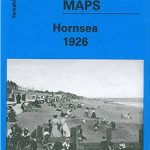 Hornsea 1926
 Urmston 1926
Irlam Hall 1926
Urmston 1926
Irlam Hall 1926
 Hunmanby 1926
Hampton Court & East Molesey 1912 – 12.13
Lower Irlam and Cadishead 1926
Bromsgrove 1926
Bewdley 1926
Hunmanby 1926
Hampton Court & East Molesey 1912 – 12.13
Lower Irlam and Cadishead 1926
Bromsgrove 1926
Bewdley 1926
 Great Driffield 1909
 Great Britain: Godfrey Editions of Historical Ordnance Survey “A Yard to the Mile” City Plans
Brightlingsea 1895
Great Britain: Godfrey Editions of Historical Ordnance Survey “A Yard to the Mile” City Plans
Brightlingsea 1895
 Croydon East: Coombe Park & Addiscombe Road 1895 – 158
East Barnet & Southgate 1897 – 7.09
Croydon East: Coombe Park & Addiscombe Road 1895 – 158
East Barnet & Southgate 1897 – 7.09
 East Finchley 1894 – 10.2
 Great Britain: Godfrey Editions of Historical Ordnance Survey Inch to a Mile Maps of England & Wales
 Eltham Green 1894 – 120.2
Maldon (East) 1920 – 56.13
Eltham Green 1894 – 120.2
Maldon (East) 1920 – 56.13
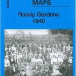 Ruislip Gardens 1940
Halesowen (East) 1913 – 5.13b
East Boldon 1895
Ruislip Gardens 1940
Halesowen (East) 1913 – 5.13b
East Boldon 1895
 Great Bridge and Toll End 1902
Colwyn Bay South East 1911
Great Bridge and Toll End 1902
Colwyn Bay South East 1911
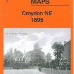 Croydon North-East 1895
Redditch East 1903
East Ham & Barking 1915 – 44.3
East Jarrow 1913
Croydon North-East 1895
Redditch East 1903
East Ham & Barking 1915 – 44.3
East Jarrow 1913
 Wavertree and Broad Green 1905
Durham City East 1894
Wavertree and Broad Green 1905
Durham City East 1894
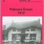 Palmers Green 1912 – 7.14a
Bolton South and Great Lever 1927
Palmers Green 1912 – 7.14a
Bolton South and Great Lever 1927
 Bromley Common and North-East Hayes 1895
Craigendoran and Helensburgh East 1897
Wylde Green 1913
Barnsley North East 1904
Thames Ditton 1895 – 12.07
Manchester South-East 1915
Bromley Common and North-East Hayes 1895
Craigendoran and Helensburgh East 1897
Wylde Green 1913
Barnsley North East 1904
Thames Ditton 1895 – 12.07
Manchester South-East 1915