Disclosure : This site contains affiliate links to products. We may receive a commission for purchases made through these links.
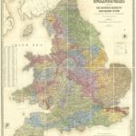
Great Britain: Victorian England & Wales 1897 Maps from the Old House Books
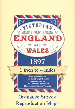
England and Wales on nine sheets from Old House Books reproducing mapping originally published in 1897 in The Royal English Atlas to mark Queen Victoriaโ€s Diamond Jubilee. Each map comes with a small booklet describing Victorian Britain and is presented in a protective envelope.Reproduced at a scale of 4 miles to one inch and predominantly in black and white, the maps show rivers, woodlands and main roads in colour, with county boundaries also highlighted by colouring. Railway lines are shown with stations. Topography is presented by old style hachuring, which so vividly depicts more hilly and mountainous terrain, and plenty of names of geographical features are included. In the coastal waters bathymetric contours and sandbanks are marked. Latitude and longitude lines are drawn at 10` and 5` intervals respectively.

Related Products:
 West Wales 1897
 East Wales and West Midlands 1897
 Great Britain: Cassini Historical Reproductions of Ordnance Survey One-Inch Maps of England & Wales
 Great Britain: Philip`s “Red Books” Regional and County Tourist Maps
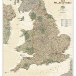
 England and Wales NGS Classic Wall Map PAPER
 England and Wales NGS Executive Wall Map PAPER
 Great Britain: Sustrans/CycleCity Cycling Maps of Great Britain & Northern Ireland
 Great Britain: A-Z Five Miles to One Inch Wall Maps
 Great Britain: Godfrey Editions of Historical Ordnance Survey Inch to a Mile Maps of England & Wales
 England and Wales NGS Classic Wall Map ENCAPSULATED
 Great Britain: Reproductions of Old City Maps from the Old House Books
Southern England – Wales Reise Know-How
Great Britain: Reproductions of Old City Maps from the Old House Books
Southern England – Wales Reise Know-How
 Great Britain: Ordnance Survey Tour Maps
 Fodor`s Essential Great Britain: with the Best of England, Scotland & Wales
 England and Wales NGS Executive Wall Map ENCAPSULATED
 Victorian Maps of England: The county and city maps of Thomas Moule
 Great Britain: A-Z Five Miles to One Inch Road Maps
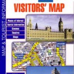 Great Britain: A-Z Visitors` Maps and Atlases
 Great Britain: Speede County Maps of Great Britain
 Great Britain: Freedom to Roam Rambling Guides for England and Wales
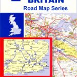
 Great Britain: AA Regional Road Maps
 Great Britain: A-Z Regional Road Maps and Atlases
 Old Folding Maps Reproductions of Letts 1884 English County Maps
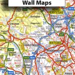
 Great Britain: A-Z Regional Wall Maps
 Great Britain: A-Z Towns and Cities Street Atlases
 Great Britain Mountain Biking: The Best Trail Riding in England, Scotland and Wales
 Great Britain: Harvey British Mountain Maps
 Britain and Ireland NGS Classic Wall Map PAPER
 Great Britain: Michelin 400K Road Maps
Great Britain: Ordnance Survey 250K Regional Maps
Great Britain: Michelin 400K Road Maps
Great Britain: Ordnance Survey 250K Regional Maps
 Great Britain: A-Z County Street Atlases
 Great Britain: Goldeneye Cycling Country Lanes & Traffic-Free Family Routes Maps
 Great Britain: AA/Ordnance Survey 25K Walker`s Maps
 Spain: CNIG 500K Regional Road Maps
 Great Britain Birds: A Folding Pocket Guide to Familiar Species of England, Scotland & Wales
 A5 Postcard – Stanford`s Railway Map of England and Wales
 Coastal Britain: England and Wales: Celebrating the history, heritage and wildlife of Britain`s shores
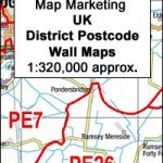 Great Britain: Map Marketing District Postcode Maps
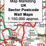 Great Britain & Northern Ireland: Map Marketing Postcode Sector Maps