Disclosure : This site contains affiliate links to products. We may receive a commission for purchases made through these links.
Great Britain: Philip`s Road Atlases
Road Atlases of Great Britain from Philipโ€s in 12 different versions presenting the country in variety of formats and scales. The atlases can be grouped into three types, according to their scale and the presentation of the road network โ€“ additional features of each title are listed in its individual description. – NAVIGATOR TITLES: Nos. 1 to 4 at 1:100,000 (1โ€ to 1โ€ to 1.58 miles) have a very detailed presentation of the road network showing more minor roads and tracks, as well as more small locations such as farms, hamlets, etc, than in the annually updated versions. These titles highlight fewer places of interest. – ANNUALLY UPDATED ATLASES: Nos. 5 to 9 at 1:200,000 (1โ€ to 3.15 miles) have fewer minor roads and small villages than shown in the Navigator titles, but show many more places of interest. The different sizes/bindings vary in the additional features included in them – mainly in the number of urban approach maps and street plans.OTHER FORMATS: Compact Atlas (No.10 at 1:212,850 / 1โ€ to 3.33 miles) and Driverโ€s Atlas (No. 11 at 1:265,000 / 1โ€ to 4.18 miles) have the same cartography as the annual versions, but the reduction in scale means smaller size print and less clarity; the Compact version has also fewer place names in its index. The Concise Atlas (No. 12 at 1:506,880 / 1โ€ to 8 miles) has a much more limited presentation of the road network and no places of interest.PLEASE NOTE: scale quoted above are for England, Wales and southern Scotland; Scottish Highlands and the islands are covered at slightly smaller scales. For more information about the additional features is provided in each titleโ€s individual description.

Related Products:
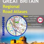 Great Britain: Philip`s Navigator Regional Road Atlases
 Great Britain: A-Z Regional Road Maps and Atlases
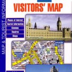 Great Britain: A-Z Visitors` Maps and Atlases
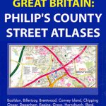 Great Britain & Northern Ireland: Philip`s County Street Atlases
 Great Britain: Philip`s City Street Atlases
 Britain & Ireland Philip`s Big Road Atlas 2017
 Britain & Ireland Philip`s Complete Road Atlas 2017 SPIRAL-BOUND
 Ireland: Collins Road Atlases
 Great Britain: Michelin 400K Road Maps
 Great Britain: A-Z County Street Atlases
 London: Philip`s Street Atlases
 Britain Philip`s Driver`s Road Atlas A4 PAPERBACK
 Britain and Ireland Philip`s Road Atlas 2022 A4 PAPERBACK
 Britain Philip`s Navigator Road Atlas FLEXI-BOUND
 Britain & Ireland Philip`s Essential Road Atlas 2021 A4 PAPERBACK
 Britain & Ireland Philip`s Road Atlas 2022 A4 SPIRAL-BOUND
 Britain Philip`s Navigator Road Atlas SPIRAL-BOUND
 Britain & Ireland Philip`s Motorist`s Road Atlas 2019 A3 PAPERBACK
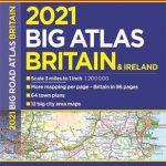 Britain & Ireland Philip`s Big Road Atlas 2021 A3 PAPERBACK
 Great Britain: A-Z Towns and Cities Street Atlases
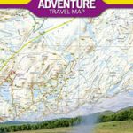
 Great Britain: A-Z/Ordnance Survey 25K Adventure Atlases
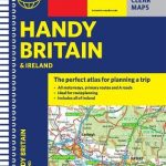 Britain & Ireland Philip`s Handy Road Atlas A5 SPIRAL-BOUND
 Britain Philip`s Navigator Trucker`s Road Atlas A3 SPIRAL-BOUND
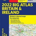 Britain & Ireland Philip`s Big Road Atlas 2022 A3 PAPERBACK
 Britain & Ireland Philip`s Big Road Atlas 2022 A3 SPRIAL-BOUND
 Britain Philip`s Navigator Easy-Use Road Atlas
 Britain & Ireland Philip`s Complete Road Atlas 2020 HARDBACK
 Britain & Ireland Philip`s Complete Road Atlas 2020 SPIRAL-BOUND
 USA: Rand McNally Road Atlases 2018
 Russia: Roskartografia Regional Road Atlases
 Great Britain: A-Z Five Miles to One Inch Road Maps
 Australia: UBD Gregory`s Road Atlases
 Great Britain A-Z Handy Road Atlas 2021
 Britain Philip`s Easy to Read Road Atlas 2022 A4 PAPERBACK
Great Britain & Northern Ireland A-Z Road Atlas 2023 A3 PAPERBACK
Britain Philip`s Easy to Read Road Atlas 2022 A4 PAPERBACK
Great Britain & Northern Ireland A-Z Road Atlas 2023 A3 PAPERBACK
 Britain Philip`s Navigator Camping and Caravanning Road Atlas
 Great Britain & Northern Ireland A-Z Road Atlas 2022 A3 PAPERBACK
 Great Britain & Northern Ireland A-Z Road Atlas 2021 A3 PAPERBACK
 Benelux: Michelin Regional Road Maps and Atlases
 London: A-Z Street Atlases and Maps