Disclosure : This site contains affiliate links to products. We may receive a commission for purchases made through these links.
Great Britain: OS Administrative Maps
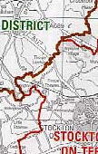
The maps show the county, district and unitary authority boundaries clearly in different colours. The background is in grey and white, and shows towns, villages and roads.Maps in this series are only published as flat versions.

Related Products:
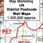 Great Britain: Map Marketing District Postcode Maps
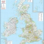
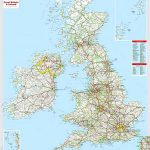
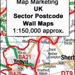 Great Britain & Northern Ireland: Map Marketing Postcode Sector Maps
 Great Britain: Speede County Maps of Great Britain
 Great Britain & Ireland Michelin Wall Map PAPER
 Great Britain & Ireland Michelin Wall Map ENCAPSULATED
 Great Britain: Philip`s City Street Atlases
 Old Folding Maps Reproductions of Letts 1884 English County Maps
 Great Britain: A-Z Five Miles to One Inch Wall Maps
 Great Britain: A-Z Visitors` Maps and Atlases
 Great Britain: AA Regional Road Maps
 Great Britain: Sustrans/CycleCity Cycling Maps of Great Britain & Northern Ireland
 Great Britain: Nicolson Street Guide Maps
 Great Britain: Philip`s “Red Books” Regional and County Tourist Maps
 Great Britain: Victorian England & Wales 1897 Maps from the Old House Books
 Great Britain: A-Z Five Miles to One Inch Road Maps
 Great Britain: JJM Designs Pub Stops Wall Maps
 Great Britain A-Z REVERSIBLE Road Map
 Great Britain: Maps International British Isles Planning Map ENCAPSULATED
 Great Britain: A-Z Towns and Cities Street Atlases
 Great Britain: Ordnance Survey Tour Maps
Great Britain: Ordnance Survey 250K Regional Maps
Great Britain: Ordnance Survey Tour Maps
Great Britain: Ordnance Survey 250K Regional Maps
 Great Britain: Harvey British Mountain Maps
 Great Britain: The Daily Telegraph Wall Map of Great Britain & Ireland
 Great Britain: The Daily Telegraph Wall Map of Great Britain & Ireland (ENCAPSULATED)
 Ukraine: Kartografija`s 250K Maps of the Administrative Regions
 Great Britain: Michelin 400K Road Maps
 Great Britain: A-Z County Street Atlases
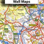
 Great Britain: A-Z Regional Wall Maps
 India: Eicher State Road Maps
Great Britain: Harvey Maps of Long-distance Hiking Trails
India: Eicher State Road Maps
Great Britain: Harvey Maps of Long-distance Hiking Trails
 Great Britain: Godfrey Editions of Historical Ordnance Survey Inch to a Mile Maps of England & Wales
 Great Britain A-Z Handy Road Atlas 2021
 Great Britain A-Z Handy Road Atlas 2022 A5 SPIRAL-BOUND
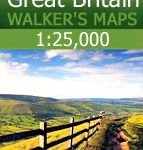 Great Britain: AA/Ordnance Survey 25K Walker`s Maps
Great Britain A-Z Handy Road Atlas 2023 A5 SPIRAL-BOUND
Great Britain and Ireland: Harvey Superwalker & Ultramap Maps
Great Britain: AA/Ordnance Survey 25K Walker`s Maps
Great Britain A-Z Handy Road Atlas 2023 A5 SPIRAL-BOUND
Great Britain and Ireland: Harvey Superwalker & Ultramap Maps
 Great Britain: Reproductions of Old City Maps from the Old House Books
 Great Britain: CroydeCycle Local Walking Maps of the West Country
 Asia: Maps International Political Wall Maps