Disclosure : This site contains affiliate links to products. We may receive a commission for purchases made through these links.
Great Britain: Ordnance Survey 250K Regional Maps
Great Britain in a series of eight maps at 1:250,000 from the Ordnance Survey with excellent presentation of the landscape by altitude colouring with contours and hill shading, plus prominent highlighting of National and Forest Parks, ideal for planning interesting picturesque routes.Making a much appreciated return to the Ordnance Survey catalogue in autumn 2016, maps in this series have bold altitude colouring enhanced by hill shading and contours at 200 feet (61 metres approx) intervals: spot heights are given in metres. Boundaries of National and Forest Parks are prominently marked and further colouring shows woodlands and sandy beaches. Road network, finely graded into 10 types, indicates dual carriageways and road width, primary route destinations, restricted junctions, services, tolls, narrow roads with passing places, steep gradients, level crossings, etc. Railways are shown with stations and ferry connections indicate crossing times. A range of symbols highlight various facilities and places of interest including campsites, youth hostels, information centres, historic sites and buildings, etc. The maps have the lines of the British National grid at 10km intervals, plus latitude and longitude margin ticks at 10โ€. The index lists main towns.

Related Products:
 Great Britain: Ordnance Survey Tour Maps
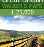 Great Britain: AA/Ordnance Survey 25K Walker`s Maps
 Great Britain: Ordnance Survey Off-Road Cycle Trails
 Great Britain: Cassini Historical Reproductions of Ordnance Survey One-Inch Maps of England & Wales
 Great Britain: Godfrey Editions of Historical Ordnance Survey Inch to a Mile Maps of England & Wales
 Great Britain: A-Z/Ordnance Survey 25K Adventure Atlases
 Ireland: Ordnance Survey of Ireland 50K Discovery Maps
 Iceland: 250K Topographic Survey Road Maps
 Great Britain: A-Z Regional Road Maps and Atlases
 Great Britain: Godfrey Editions of Historical Ordnance Survey “A Yard to the Mile” City Plans
 Ordnance Survey The Great British Colouring Map: A Colouring Journey Around Britain
 Great Britain and Ireland: Godfrey Editions of Historical Ordnance Survey 25″ Street Plans
 Great Britain: AA Regional Road Maps
 South Africa: 250K Topographic Survey Maps
 Great Britain: A-Z Regional Wall Maps
 Mexico: 250K Topographic Survey Maps
 Ireland: 250K Holiday Maps
 Great Britain: Sustrans/CycleCity Cycling Maps of Great Britain & Northern Ireland
 The Ordnance Survey Puzzle Tour of Britain: A Journey Around Britain in Puzzles
Old Ordnance Survey Maps of London
Old Ordnance Survey Maps of Upminster
France: IGN 200/250K Regional Maps
The Ordnance Survey Puzzle Tour of Britain: A Journey Around Britain in Puzzles
Old Ordnance Survey Maps of London
Old Ordnance Survey Maps of Upminster
France: IGN 200/250K Regional Maps
 Great Britain: Harvey British Mountain Maps
 Ordnance Survey Explorer Maps: Complete Set
 Great Britain: Philip`s “Red Books” Regional and County Tourist Maps
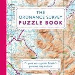 The Ordnance Survey Puzzle Book: Pit your wits against Britain`s greatest map makers
 Sweden: Lantmรคteriet 250K Topographic Survey
 Great Britain: Philip`s Navigator Regional Road Atlases
 Great Britain: Michelin Regional Tourist Maps
 Great Britain: A-Z Five Miles to One Inch Road Maps
 Ordnance Survey Maps: A Concise Guide for Historians
 Great Britain: Michelin 400K Road Maps
 Great Britain: A-Z Five Miles to One Inch Wall Maps
 Luxembourg: 50K Topographic Survey Maps
 Ordnance Survey Great British Travel Journal
 Great Britain: Harvey Summit Maps
 The Ordnance Survey Great British Treasure Hunt: Solve the Clues on a Puzzle Adventure
 Ordnance Survey Landranger Maps: Complete Set
 Spain: CNIG 500K Regional Road Maps
 Great Britain: OS 25K Explorer Maps (Paper and Waterproof Editions)