Disclosure : This site contains affiliate links to products. We may receive a commission for purchases made through these links.
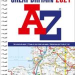
Great Britain & Northern Ireland A-Z Road Atlas 2022 A3 PAPERBACK
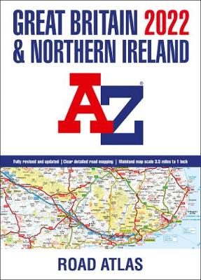
A large A3-size, full colour, paperback road atlas, now fully revised and updated. Clear detailed road mapping at a mainland map scale of 3.5 miles to 1 inch. This essential road atlas includes the following;* 11 pages of main route mapping covering Greater London, Birmingham and Manchester* Route planning maps* Mileage chart with average journey times* Information on motorway junctions with limited interchanges* 70 city and town centre street plans* 16 port and airport plans* Channel Tunnel terminus maps* Index to cities, towns, villages, hamlets, major destinations and selected places of interest with postcodes for sat-nav use* Map reference information also in French and German Instantly recognizable and easy to use, A-Z road mapping includes the following features: Clear standard road classification colours for easy identification, Full motorway junction detail, Under construction and proposed roads, Primary route destinations, Service areas Selected truckstop locations, National and county boundaries and A wide range of tourist and ancillary information, including Blue Flag Beaches. The combination of map scale and large format gives a double-page driving range of 60 miles north to south and 80 miles east to west, making this publication the ideal motoring companion.

Related Products:
 Great Britain & Northern Ireland A-Z Road Atlas 2023 A3 PAPERBACK
 Great Britain & Northern Ireland A-Z Road Atlas 2021 A3 PAPERBACK
 Great Britain & Northern Ireland A-Z Super Scale Road Atlas 2022 A3 SPIRAL-BOUND
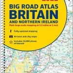
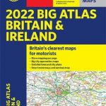
 Britain and Northern Ireland Collins Big Road Atlas 2022 A3 PAPERBACK
Great Britain & Northern Ireland A-Z Super Scale Road Atlas 2023 A3 SPIRAL-BOUND
Britain and Northern Ireland Collins Big Road Atlas 2022 A3 PAPERBACK
Great Britain & Northern Ireland A-Z Super Scale Road Atlas 2023 A3 SPIRAL-BOUND
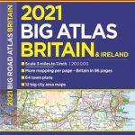
 Britain and Northern Ireland Collins Big Road Atlas 2021 A3 PAPERBACK
Britain and Northern Ireland Collins Big Road Atlas 2023 A3 PAPERBACK
Britain and Northern Ireland Collins Big Road Atlas 2021 A3 PAPERBACK
Britain and Northern Ireland Collins Big Road Atlas 2023 A3 PAPERBACK
 Great Britain A-Z Road Atlas 2022 A4 SPIRAL-BOUND
 Britain and Ireland Philip`s Road Atlas 2022 A4 PAPERBACK
 Britain and Northern Ireland Collins Big Road Atlas 2022 A3 SPIRAL-BOUND
 Britain & Ireland Philip`s Big Road Atlas 2022 A3 PAPERBACK
Britain and Northern Ireland Collins Essential Road Atlas 2022 A4 SPIRAL-BOUND
Britain & Ireland Philip`s Big Road Atlas 2022 A3 PAPERBACK
Britain and Northern Ireland Collins Essential Road Atlas 2022 A4 SPIRAL-BOUND
 Great Britain A-Z Handy Road Atlas 2022 A5 SPIRAL-BOUND
Britain and Northern Ireland Collins Big Road Atlas 2023 A3 SPIRAL-BOUND
Great Britain A-Z Handy Road Atlas 2022 A5 SPIRAL-BOUND
Britain and Northern Ireland Collins Big Road Atlas 2023 A3 SPIRAL-BOUND
 Britain & Ireland Philip`s Big Road Atlas 2021 A3 PAPERBACK
 Britain & Ireland Philip`s Essential Road Atlas 2021 A4 PAPERBACK
 Britain Philip`s Easy to Read Road Atlas 2022 A4 PAPERBACK
 Britain & Ireland Philip`s Motorist`s Road Atlas 2019 A3 PAPERBACK
 Britain & Ireland Philip`s Road Atlas 2022 A4 SPIRAL-BOUND
 Britain and Northern Ireland Collins Essential Road Atlas 2021
 Great Britain A-Z Handy Road Atlas 2021
Great Britain A-Z Road Atlas 2023 A4 SPIRAL-BOUND
Great Britain A-Z Handy Road Atlas 2021
Great Britain A-Z Road Atlas 2023 A4 SPIRAL-BOUND
 Britain & Ireland Philip`s Big Road Atlas 2022 A3 SPRIAL-BOUND
Great Britain A-Z Handy Road Atlas 2023 A5 SPIRAL-BOUND
Britain & Ireland Philip`s Big Road Atlas 2022 A3 SPRIAL-BOUND
Great Britain A-Z Handy Road Atlas 2023 A5 SPIRAL-BOUND
 Britain Philip`s Big Easy to Read Road Atlas 2022 A3 SPIRAL-BOUND
 Britain & Ireland Philip`s Complete Road Atlas 2020 SPIRAL-BOUND
 Britain and Ireland Collins Handy Road Atlas 2022 A5 SPIRAL-BOUND
 Britain & Ireland Philip`s Complete Road Atlas 2020 HARDBACK
 Britain & Ireland Philip`s Handy Road Atlas A5 SPIRAL-BOUND
 Britain & Ireland Philip`s Big Road Atlas 2017
 Britain & Ireland Philip`s Complete Road Atlas 2017 SPIRAL-BOUND
 Britain Philip`s Driver`s Road Atlas A4 PAPERBACK
 Ireland AA Road Atlas
 Britain AA Big Road Atlas 2022 PAPERBACK
Northern England Regional A-Z Road Atlas
Britain AA Big Road Atlas 2022 PAPERBACK
Northern England Regional A-Z Road Atlas
 Great Britain & Ireland Michelin Main Roads Atlas 2021 A4 PAPER
 Britain and Ireland Collins Handy Road Atlas 2021 A5 SPIRAL-BOUND
 Postcode Atlas of Britain and Northern Ireland
 Great Britain & Ireland Michelin Main Roads Atlas 2021 SPIRAL-BOUND
Britain and Ireland Collins Handy Road Atlas 2023 A5 SPIRAL-BOUND
Great Britain & Ireland Michelin Main Roads Atlas 2021 SPIRAL-BOUND
Britain and Ireland Collins Handy Road Atlas 2023 A5 SPIRAL-BOUND