Disclosure : This site contains affiliate links to products. We may receive a commission for purchases made through these links.
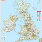
Great Britain: Maps International British Isles Planning Map ENCAPSULATED
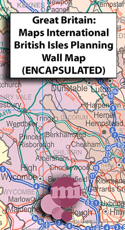
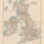
Encapsulated wall map of the British Isles and Ireland from Maps International; at 1:600,000 and measuring 110x160cm, this is one of our largest single sheet maps of Great Britain, almost twice the size of most other wall maps we stock.Cartography shows motorways and A roads with interchanges and service areas indicated, as well as railway lines and international airports. Counties are prominently highlighted in different colours, with their boundaries clearly marked. Ireland and Northern Ireland are shown at 1:1,500,000, and an enlargement shows Greater London and its boroughs at 1:450,000. Both the British Isles and Ireland are indexed and grid-referenced.A distance table is also included, with all data given in kilometres.*This is the encapsulated edition:* the map has been sealed between two sheets of plastic and therefore is more rigid and heavier than laminated maps of the same size. It is also damp-proof and will not crinkle in humid conditions. Encapsulation gives the map a shiny surface, similar to being displayed behind glass.

Related Products:
 British Isles Maps International Planning Map PAPER
 British Isles Map Marketing Route Planning Wall Map ENCAPSULATED
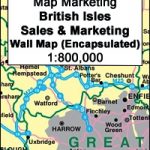 British Isles Map Marketing Sales & Marketing Wall Map ENCAPSULATED
 British Isles Global Mapping Political Wall Map ENCAPSULATED
British Isles Political Wall Map SMALL ENCAPSULATED
British Isles Global Mapping Political Wall Map ENCAPSULATED
British Isles Political Wall Map SMALL ENCAPSULATED
 British Isles Wall Map lemon – orange – thistle – khaki ENCAPSULATED
 Europe Maps International Political Wall Map LARGE ENCAPSULATED
 Africa Maps International Political Wall Map ENCAPSULATED
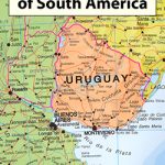 South America Maps International Political Wall Map ENCAPSULATED
 Asia Maps International Political Wall Map ENCAPSULATED
 Europe Maps International Political Wall Map X-LARGE ENCAPSULATED
 Great Britain: The Daily Telegraph Wall Map of Great Britain & Ireland (ENCAPSULATED)
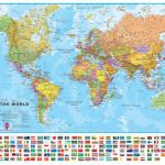
 World Maps International Political Wall Map SMALL ENCAPSULATED
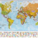
 World Maps International Political Wall Map LARGE ENCAPSULATED
 World Maps International Political Upside-down Wall Map LARGE ENCAPSULATED
 Britain and Ireland NGS Classic Wall Map ENCAPSULATED
British Isles Political Wall Map PAPER
Britain and Ireland NGS Classic Wall Map ENCAPSULATED
British Isles Political Wall Map PAPER
 Great Britain & Ireland Michelin Wall Map ENCAPSULATED
 British Isles: Stanfords Map of the British Isles c.1859 SMALL
 Britain and Ireland NGS Executive Wall Map ENCAPSULATED
 World Maps International Physical Wall Map X-LARGE ENCAPSULATED
British Isles Global Mapping Political Wall Map SMALL PAPER
British Isles Wall Map lemon – orange – thistle – khaki PAPER
World Maps International Physical Wall Map X-LARGE ENCAPSULATED
British Isles Global Mapping Political Wall Map SMALL PAPER
British Isles Wall Map lemon – orange – thistle – khaki PAPER
 Stanford`s Folio British Isles Map (1884) – A4 Wall Map, Paper
Stanford`s Folio British Isles Map (1884) – A3 Wall Map, Paper
Stanford`s Folio British Isles Map (1884) – A2 Wall Map, Canvas
Stanford`s Folio British Isles Map (1884) – A4 Wall Map, Canvas
Stanford`s Folio British Isles Map (1884) – A3 Wall Map, Canvas
Stanford`s Folio British Isles Map (1884) – A1 Wall Map, Paper
Stanford`s Folio British Isles Map (1884) – A1 Wall Map, Canvas
Stanford`s Folio British Isles Map (1884) – A4 Wall Map, Paper
Stanford`s Folio British Isles Map (1884) – A3 Wall Map, Paper
Stanford`s Folio British Isles Map (1884) – A2 Wall Map, Canvas
Stanford`s Folio British Isles Map (1884) – A4 Wall Map, Canvas
Stanford`s Folio British Isles Map (1884) – A3 Wall Map, Canvas
Stanford`s Folio British Isles Map (1884) – A1 Wall Map, Paper
Stanford`s Folio British Isles Map (1884) – A1 Wall Map, Canvas
 British Isles Explorer
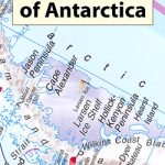 Antarctica: Maps International Wall Maps
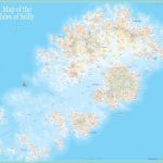 Map of the Isles of Scilly Wall Map ENCAPSULATED
 Stanford`s Folio British Isles Map (1884) – A1 Wall Map, Canvas – Special Edition
Stanford`s Folio British Isles Map (1884) – A2 Wall Map, Paper – Print on Demand
Stanford`s Folio British Isles Map (1884) – A1 Wall Map, Canvas – Special Edition
Stanford`s Folio British Isles Map (1884) – A2 Wall Map, Paper – Print on Demand
 British Isles Communication OS Wall Map LAMINATED
 Stanford`s Folio British Isles Map (1884) – A1 Wall Map, Paper – Special Edition – Print on Demand
 Great Britain: Harvey British Mountain Maps
Asia: Maps International Political Wall Maps
Great Britain: Harvey British Mountain Maps
Asia: Maps International Political Wall Maps