Disclosure : This site contains affiliate links to products. We may receive a commission for purchases made through these links.
Great Britain: Heron Canal Maps
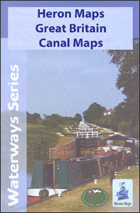
Heron Maps specialise in the mapping of the Inland Waterways of Great Britain, covering a selection of the countryโ€s canal system and inland waterways. The maps feature an exaggerated depiction of the main waterway with a corridor of surrounding detail, usually at 1:50000 scale, showing waterway related information pertinent to both waterways and leisure users, such as locks, boatyards, facilities and the all important waterside pubs. Boat user information includes distance indicators, cuttings/embankments, towpaths, long/short term moorings, slipways, refuse/sewage disposal points, water points and boatyards is provided. Tourist information is indicated by legend symbols which show the locations of things like tourist information centres, camping sites, boat hire, museums, walking paths and picnic sites. Car parks, transport details and road networks are included as of secondary importance in areas surrounding the waterway.For more information see individual descriptions.

Related Products:
 Great Britain: Inland Waterways` Maps
 Llangollen and Montgomery Canal Heron Maps
 Grand Union Canal – Birmingham to Milton Keynes Heron Maps
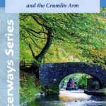 Monmouthshire and Brecon Canal – and Crumlin Arm Heron Map
 Grand Union Canal – Braunston to Kings Langley Heron Map
 Grand Union Canal: Stoke Bruerne to Leicester, River Soar & Erewash Canal Heron Map
 Warwickshire Ring, Ashby-de-la-Zouch Canal & up to Fradley Junction Heron Map
 River Thames and the Thames Path Heron Maps
 Great Britain: Pearson`s Canal Companions
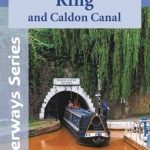 Four Counties Ring & Caldon Canal Heron Map
 Kennet & Avon Canal – River Avon Heron Map
 Shropshire Union Canal, incl. Middlewich Branch & up to Gr. Haywood Junction Heron Map
 Birmingham Canal Navigations Heron Map
 Oxford Canal: Oxford to Hawkesbury Junction & to Coventry Basin Heron Map
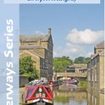 Leeds and Liverpool Canal – Liverpool to Keighley Heron Map
 Grand Union Canal: Braunston to Kings Langley Heron Map
 Canal and River Cruising Planner of Great Britain
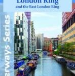 Grand Union Canal: Milton Keynes to London, with the London & East London Rings Heron Map
 Grand Union Canal – Milton Keynes to London and the London Ring Heron Maps
France: Editions du Breil Guides to Inland Waterways
Grand Union Canal – Milton Keynes to London and the London Ring Heron Maps
France: Editions du Breil Guides to Inland Waterways
 Great Britain Inland Waterways
 Great Britain: OS 25K Explorer Maps (Paper and Waterproof Editions)
The Broads Heron Maps
Great Britain: OS 25K Explorer Maps (Paper and Waterproof Editions)
The Broads Heron Maps
 Stourport Ring & Droitwich Ring Heron Map
 Great Britain: Speede County Maps of Great Britain
 River Thames & Thames Path Heron Map
 Great Britain: Sustrans/CycleCity Cycling Maps of Great Britain & Northern Ireland
 Kennet & Avon Canal and River Thames Pearson`s Canal Companion
 Avon Ring and Droitwich Ring Heron Map
 Great Britain Collins Nicholson Inland Waterways Map
 Leeds & Liverpool Canal – Foulridge to Leeds; Aire & Calder to Knottingley; Calder & Hebble Heron Map
 Great Britain: Philip`s “Red Books” Regional and County Tourist Maps
 Great Britain: AA/Ordnance Survey 25K Walker`s Maps
 Great Britain: Harvey British Mountain Maps
 Great Britain: Nicolson Street Guide Maps
 Great Britain: Michelin 400K Road Maps
Great Britain: Harvey Maps of Long-distance Hiking Trails
Great Britain: Michelin 400K Road Maps
Great Britain: Harvey Maps of Long-distance Hiking Trails
 Great Britain: Inland Waterways Map
 Great Britain: OS 50K Landranger Maps (Paper and Waterproof Editions)