Disclosure : This site contains affiliate links to products. We may receive a commission for purchases made through these links.
Great Britain and Ireland: Godfrey Editions of Historical Ordnance Survey 25″ Street Plans

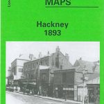
Fascinating series of reproductions of old Ordnance Survey plans in the Alan Godfrey Editions, ideal for anyone interested in the history of their neighbourhood or family. Selected towns in Great Britain and Ireland are covered by maps showing the extent of urban development in the last decades of the 19th and early 20th century. The plans, published mostly in black and white, have been taken from the Ordnance Survey mapping at 1:2,500 (25โ€ to 1 mile) and reprinted at about 15 inches to one mile (1:4,340). They cover towns in great detail, showing individual houses and property boundaries, railway tracks, factories, churches, mills, canals, tramways and even minutiae such as dockside cranes, fountains, signal posts, pathways, sheds, wells, etc.On the reverse most maps have historical notes on the area concerned. Many also include extracts from contemporary directories, listing local inhabitants or businesses house by house. The maps are ideal for local historians, transport historians, family historians, or simply those with an interest in the town they live in or have visited. SHEET REFERENCE NUMBERS: Alan Godfreyโ€s reproductions use the sheet reference sequence of the original Ordnance Surveyโ€s maps which were arranged by county. We recommend, therefore, viewing the series by a county or a city location rather than the whole list.PLEASE NOTE: The maps are highly detailed so they do not present a large area. Most maps cover about one and a half square miles: normally one mile (1.6kms) north/south, and one and a half miles (2.4kms) across. Adjoining sheets can be assembled together to provide wider coverage.


