Disclosure : This site contains affiliate links to products. We may receive a commission for purchases made through these links.
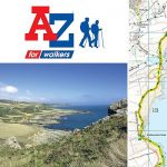
Great Britain: A-Z/Ordnance Survey 25K Adventure Atlases
Selected hiking areas of Britain on handy size Adventure Atlases at 1:25,000 from Geographers` A-Z Map Company with cartography from the Ordnance Surveyโ€s Explorer series. Each title has an index which includes geographical features, nature reserves, youth hostels and car parks, etc, and provides QR codes for other useful information.The atlases have cartography of the Ordnance Surveyโ€s Explorer series and provide plenty of recreational and tourist information, indicating traditional public rights of way paths, including bridleways and byways restricted or open to motorized traffic. Also shown are other routes with public access, including permissive footpaths and bridleways. Special marking indicates National Trails, Long-distance Routes and Recreational Routes, and for cyclists the maps show traffic-free routes and the National Cycle Network. A wide range of symbols highlights locations of special tourist interest: camping and caravanning sites, youth hostels, information offices and visitorsโ€ centres, parking and picnicking places, historic buildings (indicating where appropriate National Trust, English Heritage, or Cadw), sites for various recreational pursuits, country pubs, public toilets, etc. The mapping provides detailed presentation of the topography with contours at 5 or 10m intervals, numerous spot heights and colouring and/or graphics for different types of terrain or vegetation. Additional colouring shows access land, including areas managed by the National Trust, Forestry Commission and Woodland Trust. All the standard information expected of high quality survey mapping at this scale is included: finely graded road network, railway lines with stations, cuttings or embankments, individual isolated buildings, etc. For GPS each page as a 1-km British National Grid. Each atlas, presented in a handy A5 paperback format, has an index, additional notes on safety and security when walking, plus QR codes for obtaining by mobile phone information about local weather, danger areas, mountain rescue, map reading, OS national grid, etc.

Related Products:
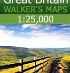 Great Britain: AA/Ordnance Survey 25K Walker`s Maps
 Great Britain: Ordnance Survey Off-Road Cycle Trails
 Great Britain: Ordnance Survey Tour Maps
 Cotswold Way A-Z Adventure Atlas
 National Three Peaks Adventure Atlas: Ben Nevis, Scafell Pike, Snowdon
 Pennine Way South A-Z Adventure Atlas
 South Downs Way A-Z Adventure Atlas
 North Downs Way A-Z Adventure Atlas
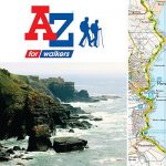
 Exmoor A-Z Adventure Atlas
 Pennine Way South Adventure Atlas: Edale – Bowes SUPERCEDED
 Pembrokeshire Coast A-Z Adventure Atlas
 Isle of Wight A-Z Adventure Atlas
 Brecon Beacons East A-Z Adventure Atlas
 Pennine Way North A-Z Adventure Atlas
 North York Moors East A-Z Adventure Atlas
 South West Coast Path 5 – Dorset A-Z Adventure Atlas
 Yorkshire Dales South Adventure Atlas
 South West Coast Path 4 – South Devon Adventure Atlas
 South West Coast Path 1 – North Devon & Somerset A-Z Adventure Atlas
 South West Coast Path 3 – South Cornwall A-Z Adventure Atlas
 Peak District – Dark Peak A-Z Adventure Atlas
 Great Britain: OS 50K Landranger Maps (Paper and Waterproof Editions)
Great Britain: Ordnance Survey 250K Regional Maps
Great Britain: OS 50K Landranger Maps (Paper and Waterproof Editions)
Great Britain: Ordnance Survey 250K Regional Maps
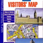 Great Britain: A-Z Visitors` Maps and Atlases
 Great Britain: OS 25K Explorer Maps (Paper and Waterproof Editions)
 Chichester & The South Downs AA Walker`s Map 20
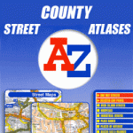 Great Britain: A-Z County Street Atlases
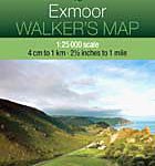 Exmoor AA Walker`s Map 13
 Isle of Wight AA Walker`s Map 16
 Lyme Bay 25K AA/OS Walker`s Map No. 11
 Aviemore & Central Cairngorms AA Walker`s Map 28
 West & Central Brecon Beacons AA Walker`s Map 18
 Great Britain: Godfrey Editions of Historical Ordnance Survey “A Yard to the Mile” City Plans
 Great Britain: Cassini Historical Reproductions of Ordnance Survey One-Inch Maps of England & Wales
 Snowdon & The Conway Valley AA Walker`s Map 4
 North York Moors West AA Walker`s Map 19
 North York Moors East 25K AA/OS Walker`s Map No. 12
 Eastbourne & Beachy Head AA Walker`s Map 30
Great Britain and Ireland: Harvey Superwalker & Ultramap Maps
Eastbourne & Beachy Head AA Walker`s Map 30
Great Britain and Ireland: Harvey Superwalker & Ultramap Maps
 The Ordnance Survey Great British Treasure Hunt: Solve the Clues on a Puzzle Adventure