Disclosure : This site contains affiliate links to products. We may receive a commission for purchases made through these links.
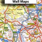
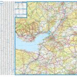
Great Britain: A-Z Five Miles to One Inch Wall Maps

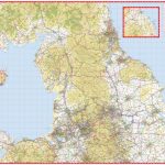
Wall maps of Great Britain from Geographers` A-Z Map Company for traditionalists who prefer their maps drawn at scales corresponding to the imperial measurements of miles to inches, with colourful presentation of topography and hill heights in feet.At a scale of 1:316,800 (5 miles to 1 inch), each map covers an extra large area, with the whole of England shown on just three sheets and Scotland presented on a double-sided map extending south to include the Lake District and the Yorkshire Dales. Presentation of the topography varies slightly, from bold altitude colouring in older editions to slightly gentler colours enhanced by relief shading on more recent maps, both very effectively showing the more hilly or mountainous parts of the country. All maps have spot heights shown in feet.The colouring of the road network clearly distinguishes between primary routes and other A roads for route planning, with B roads also easy to follow on all backgrounds. Smaller country roads are less clear to see, with the publishers recommending their alternative series for more detailed local coverage. Railway lines are included and shown with stations, but at times difficult to find. British national grid lines are overprinted on the cartography and a separate booklet is supplied containing the index to cities, towns, villages, hamlets and locations with each map.* *IMPORTANT – PLEASE NOTE: many place names and all additional tourist information is in very small lettering, requiring good eyesight or a magnifying glass.** All the titles in this series are also available in folded format and are listed on our website as road maps.

Related Products:
 Great Britain: A-Z Five Miles to One Inch Road Maps
 Great Britain: A-Z Regional Wall Maps
 Great Britain: A-Z Regional Road Maps and Atlases
 Scotland North & South A-Z Wall Map PAPER
 Great Britain: Michelin 400K Road Maps
 50 Miles Around Birmingham A-Z Wall Map
 50 Miles Around Bristol Wall Map PAPER
 Great Britain: Goldeneye Cycling Country Lanes & Traffic-Free Family Routes Maps
 Great Britain: Ordnance Survey Tour Maps
 Great Britain: AA Regional Road Maps
 Great Britain: Sustrans/CycleCity Cycling Maps of Great Britain & Northern Ireland
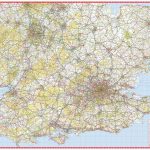
 Great Britain: Ordnance Survey 250K Regional Maps
 50 Miles Around Bristol A-Z Map
 50 Miles Around London A-Z Map
 Northern England A-Z Wall Map PAPER
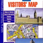 Great Britain: A-Z Visitors` Maps and Atlases
 Great Britain: Cassini Historical Reproductions of Ordnance Survey One-Inch Maps of England & Wales
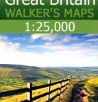 Great Britain: AA/Ordnance Survey 25K Walker`s Maps
 Great Britain: Victorian England & Wales 1897 Maps from the Old House Books
 South East & Central England A-Z Wall Map PAPER
 Great Britain: Philip`s “Red Books” Regional and County Tourist Maps
 Great Britain: Godfrey Editions of Historical Ordnance Survey Inch to a Mile Maps of England & Wales
 Great Britain: OS 50K Landranger Maps (Paper and Waterproof Editions)
 Great Britain: Michelin Regional Tourist Maps
 Great Britain: The Daily Telegraph Wall Map of Great Britain & Ireland
 Antarctica: Maps International Wall Maps
 Great Britain: The Daily Telegraph Wall Map of Great Britain & Ireland (ENCAPSULATED)
 Kent A-Z Visitors` Wall Map
Great Britain: Philip`s Road Atlases
Kent A-Z Visitors` Wall Map
Great Britain: Philip`s Road Atlases
 Great Britain & Northern Ireland ReiseKnow-How Map
 Scotland North & South A-Z Road Map
 Great Britain: Harvey British Mountain Maps
 South West England & South Wales A-Z Road Map
Great Britain: JJM Designs Pub Stops Wall Maps
South West England & South Wales A-Z Road Map
Great Britain: JJM Designs Pub Stops Wall Maps
 Great Britain: Goldeneye Map Guides
 South America: Maps International Political Wall Maps
 North America: Maps International Political Wall Maps
North America: NGS Classic Style Wall Maps
North America: Maps International Political Wall Maps
North America: NGS Classic Style Wall Maps