Disclosure : This site contains affiliate links to products. We may receive a commission for purchases made through these links.
Great Britain: A-Z County Street Atlases
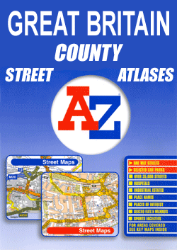
Street atlases of English counties from the Geographers` A-Z Map Company. Most atlases are in a spiral-bound format just smaller than A4 size, and offer coverage of only the built-up areas. Selected titles cover the whole county, as indicated in the individual descriptions and our area coverage images.Motorways plus A and B roads are highlighted by colouring and show route numbers. One way or restricted access streets, Park & Ride facilities and selected car parks are marked, as are on the more recently published titles locations of speed cameras. Also shown are selected cycleway routes. Where appropriate, A and B roads are annotated with selected house numbers for easier identification of addresses. Railway lines are shown with stations and level crossings. Colouring indicates different types of buildings: educational, hospitals and healthcare, industrial, leisure and recreational, shopping centres and markets, public buildings, and places of interest. Symbols mark locations of facilities usually indicated on street mapping: post offices, emergency services, public toilets, etc. Also marked are postcode and local authority boundaries. Each page has the lines and coordinates of the British National Grid.All the titles have a comprehensive index including, unless specified to the contrary in the description, separate entries for places of interest such as cultural and sport or recreational facilities, historical sites, nature reserves and gardens. Many titles include a separate list of hospitals and hospices in the area covered by the atlas.

Related Products:
 Great Britain: A-Z Towns and Cities Street Atlases
 Nottinghamshire A-Z County Street Atlas
 Great Britain: Philip`s City Street Atlases
 Great Britain & Northern Ireland: Philip`s County Street Atlases
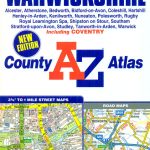 Warwickshire A-Z County Atlas
 London: A-Z Street Atlases and Maps
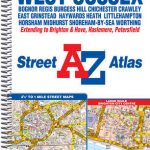 West Sussex A-Z Street Atlas
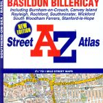 Southend-on-Sea – Basildon – Billericay A-Z Street Atlas
 Surrey A-Z Street Atlas
 Isle of Wight A-Z Street Atlas
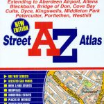 Aberdeen A-Z Street Atlas
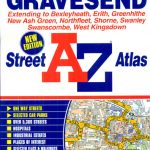 Dartford – Gravesend A-Z Street Atlas
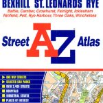 Hastings – Bexhill – St. Leonards – Rye A-Z Street Atlas
 Southport – Formby – Ormskirk – Skelmersdale A-Z Street Atlas
 Weymouth – Dorchester A-Z Street Atlas
 Bolton – Bury A-Z Street Atlas
 Macclesfield – Congleton – Knutsford – Wilmslow A-Z Street Atlas
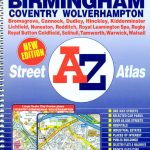 West Midlands – Birmingham – Coventry – Wolverhampton A-Z Street Atlas
 Basingstoke- Andover – Overton – Whitchurch A-Z Street Atlas
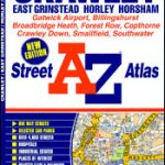 Crawley – East Grinstead – Horley – Horsham A-Z Street Atlas
 Weston-super-Mare – Burnham-on-Sea – Clevedon A-Z Street Atlas
 West Yorkshire – Leeds – Bradford A-Z Street Atlas
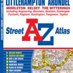 Chichester – Bognor – Littlehampton – Arundel A-Z Street Atlas
 Kingston upon Hull – Barton-upon-Humber – Beverley A-Z Street Atlas
 Loughborough – Melton Mowbray A-Z Street Atlas
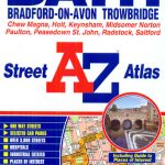 Bath – Bradford-on-Avon – Trowbridge A-Z Street Atlas
 Bangor – Conwy – Rhyl – Colwyn Bay – Llandudno A-Z Street Atlas
 Southampton – Portsmouth A-Z Street Atlas
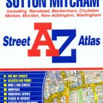 Croydon – Purley – Sutton – Mitcham A-Z Street Atlas
 Burton upon Trent – Ashby-de-la-Zouch – Coalville – Swadlincote A-Z Street Atlas
 Tyne & Wear – Newcastle upon Tyne – Sunderland A-Z Street Atlas
 Bristol – Bath A-Z Street Atlas
 Wirral – Birkenhead – Ellesmere Port – Wallasey A-Z Street Atlas
 Bournemouth – Poole – Christchurch A-Z Street Atlas
 Middlesbrough – Stockton-on-Tees A-Z Street Atlas
 Glasgow – Hamilton – Motherwell – Paisley A-Z Street Atlas
 Mansfield – Kirkby-in-Ashfield – Sutton-in-Ashfield A-Z Street Atlas
 Blackburn – Accrington – Burnley A-Z Street Atlas
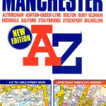 Manchester A-Z Big Street Atlas SPIRAL-BOUND
 Huddersfield – Batley – Cleckheaton – Dewsbury – Mirfield A-Z Street Atlas