Disclosure : This site contains affiliate links to products. We may receive a commission for purchases made through these links.
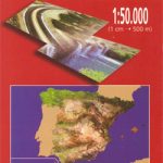
Gravalos CNIG Topo 281-2


Related Products:
 Gor CNIG Topo 993-4
Ena CNIG Topo 209-1
Ara CNIG Topo 210-1
Foz CNIG Topo 9-4
Gor CNIG Topo 993-4
Ena CNIG Topo 209-1
Ara CNIG Topo 210-1
Foz CNIG Topo 9-4
 Ona CNIG Topo 136-3
Bezanes CNIG Topo 79-2
Peralveche CNIG Topo 538-1
Torrelaguna CNIG Topo 509-2
Taboada CNIG Topo 123-3
Chantada CNIG Topo 155-1
Ibahernando CNIG Topo 730-2
Larva CNIG Topo 948-2
Albendea CNIG Topo 563-1
Moscardon CNIG Topo 588-2
Valdelagata CNIG Topo 711-1
Sierra de la Osa CNIG Topo 782-3
Turra CNIG Topo 814-1
Sober CNIG Topo 188-2
Truchas CNIG Topo 230-1
Pias CNIG Topo 266-2
Pancorbo CNIG Topo 169-1
Pradejon CNIG Topo 205-3
Corella CNIG Topo 282-1
Panticosa CNIG Topo 145-4
Longas CNIG Topo 208-2
Sadaba CNIG Topo 245-2
Valarena CNIG Topo 283-2
Ourol CNIG Topo 8-4
Castro de Rei CNIG Topo 48-3
Candin CNIG Topo 126-1
Toreno CNIG Topo 127-3
Garfin CNIG Topo 130-4
Lucillo CNIG Topo 192-4
Les Arriondes CNIG Topo 30-4
Dobro CNIG Topo 135-2
Miraveche CNIG Topo 136-4
Montorio CNIG Topo 167-1
Isar CNIG Topo 199-4
Castrojeriz CNIG Topo 237-1
Villahoz CNIG Topo 275-4
Ona CNIG Topo 136-3
Bezanes CNIG Topo 79-2
Peralveche CNIG Topo 538-1
Torrelaguna CNIG Topo 509-2
Taboada CNIG Topo 123-3
Chantada CNIG Topo 155-1
Ibahernando CNIG Topo 730-2
Larva CNIG Topo 948-2
Albendea CNIG Topo 563-1
Moscardon CNIG Topo 588-2
Valdelagata CNIG Topo 711-1
Sierra de la Osa CNIG Topo 782-3
Turra CNIG Topo 814-1
Sober CNIG Topo 188-2
Truchas CNIG Topo 230-1
Pias CNIG Topo 266-2
Pancorbo CNIG Topo 169-1
Pradejon CNIG Topo 205-3
Corella CNIG Topo 282-1
Panticosa CNIG Topo 145-4
Longas CNIG Topo 208-2
Sadaba CNIG Topo 245-2
Valarena CNIG Topo 283-2
Ourol CNIG Topo 8-4
Castro de Rei CNIG Topo 48-3
Candin CNIG Topo 126-1
Toreno CNIG Topo 127-3
Garfin CNIG Topo 130-4
Lucillo CNIG Topo 192-4
Les Arriondes CNIG Topo 30-4
Dobro CNIG Topo 135-2
Miraveche CNIG Topo 136-4
Montorio CNIG Topo 167-1
Isar CNIG Topo 199-4
Castrojeriz CNIG Topo 237-1
Villahoz CNIG Topo 275-4