Disclosure : This site contains affiliate links to products. We may receive a commission for purchases made through these links.
Grand Canyon
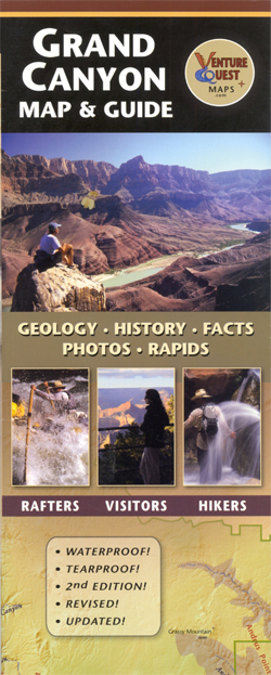
Waterproof and tear-resistant map guide of the Grand Canyon at 1:500,000 from Dragon Creek Publishing, with an enlargement of the North Rim at 1:70,000 on the reverse. Both sides of the map display information about the geology, history and other facts of the Grand CanyonThe main map at 1:500,000 covers from Lake Powell to Lake Mead with cartography for both maps showing relief through detailed shading, with simple use of colour depicting terrain types. Roads and railways are marked with route numbers prominently displayed. Hiking trails are clearly marked, along with rapids (with symbols to denote their size); rivers are shown with mile markers, park boundaries are also indicated. The enlargement of the North Rim shows a greater number of trails. Relief shading and spot heights denote topography, with the North Rim showing more spot heights. Longitude and latitude margin ticks are at intervals of 30’ and 15’ respectively.The outer edges of the map are full of illustrations, diagrams and information on the Grand Canyon, such as its formation, age, history and timelines.


