Disclosure : This site contains affiliate links to products. We may receive a commission for purchases made through these links.
Gran San Bernardo – Valle di Ollomont L`Escursionista Editore 5
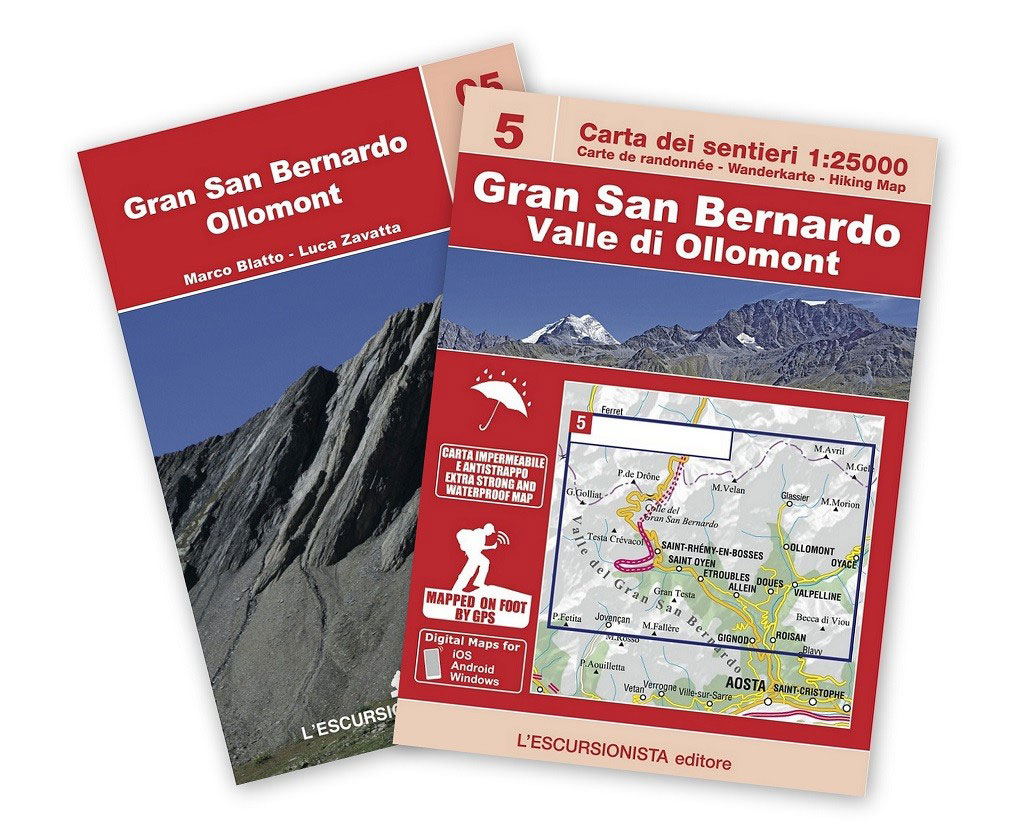
Gran San Bernardo – Valle di Ollomont, map No. 5, in a series of detailed, GPS compatible hiking maps of the Italian Alps from L’Escursionista Editore, highlighting hiking routes including the Via Ferrata climbing paths, campsites, refuges, shelters, etc. Accompanying booklet includes 14 pages of English language descriptions of three hiking trails: a 4-day Tour of the Grand San Bernard, a 2-day circuit from Etroubles, plus a 2-day Conca di Bay tour. Each includes accommodation recommendations.Maps in this L’Escursionista Editore series have clear, easy to read cartography based on the Italian topographic survey with contours at 25m intervals, enhanced by relief shading, graphic relief and colouring for glaciers and woodlands. They show numerous spot heights and names of peaks, ridges, glaciers, valleys, etc, with boundaries of national parks or other protected areas prominently marked. The overprint highlighting waymarked hiking trails gives their names and/or official numbers and indicates difficult passages and Via Ferrata climbing paths. The maps also show climbing sites and highlight locations of organized campsites, mountain refuges, bivouac places, hotels and inns/restaurants. Other information includes local unmarked tracks and footpaths, detailed classification of the road network according to widths and surface, roads closed to motorized traffic, railways and mountain transports (cable car lines, chair lifts, etc), car parks, etc. The maps have a 1-km UTM grid, plus latitude and longitude lines at intervals of 5’. Map legend includes English.To see all the titles in this series please click on the series link.

Related Products:
 Valle di Cogne – Gran Paradiso L`Escursionista Editore 10
 Valle dell`Orco – Gran Paradiso L`Escursionista Editore 14
 Valsavarenche – Gran Paradiso L`Escursionista Editore 9
 Val Soana – Valle di Ribordone – Valle di Locana L`Escursionista Editore 15
 La Thuile ‘“ Piccolo San Bernardo L`Escursionista Editore 2
Dora Baltea Canavesana – Valchiusella – Valle Sacra L`Escursionista Editore 16
La Thuile ‘“ Piccolo San Bernardo L`Escursionista Editore 2
Dora Baltea Canavesana – Valchiusella – Valle Sacra L`Escursionista Editore 16
 Valle Centrale – Saint-Barthรฉlemy – Saint-Marcel – Val Clavalite L`Escursionista Editore 13
 Monte Bianco / Mt Blanc – Courmayeur L`Escursionista Editore 1
Valpelline – Saint-Barthรฉlemy L`Escursionista Editore 6
Italy: L`Escursionista Editore 25K Hiking Maps of the Italian Alps
Monte Bianco / Mt Blanc – Courmayeur L`Escursionista Editore 1
Valpelline – Saint-Barthรฉlemy L`Escursionista Editore 6
Italy: L`Escursionista Editore 25K Hiking Maps of the Italian Alps
 Bernina – Valmalenco – Sondrio L`Escursionista Editore 21
 Valgrisenche – Val di Rhemes – Valsavarenche L`Escursionista Editore 3
 Val di Champorcher – Mont Avic L`Escursionista Editore 11
Basse valli d`Ayas e del Lys L`Escursionista Editore 12
Alte Valli di Lanzo – Val Grande – Val d`Ala – Val di Viu L`Escursionista Editore 17
Val di Champorcher – Mont Avic L`Escursionista Editore 11
Basse valli d`Ayas e del Lys L`Escursionista Editore 12
Alte Valli di Lanzo – Val Grande – Val d`Ala – Val di Viu L`Escursionista Editore 17
 Gran San Bernardo – Valle di Ollomont – Mont Fallรฉre – Aosta Valle Centrale Fraternali Editore 30
 Valtournenche – Monte Cervino / Matterhorn – Val d`Ayas West L`Escursionista Editore 7
 Monte Rosa – Ayas – Gressoney – Alagna L`Escursionista Editore 8
 La Thuile ‘“ Haute Tarentaise l`Escursionista Editore 01
 Conca di Aosta – Mont Emilius – Mont Fallere L`Escursionista Editore 4
 Cervino – Monte Rosa – Valtourenche – Valle di Champorcher L`Escursionista Editore
 Valle Maira l`Escursionista Editore
 La Valpelline – Valle di Ollomont – Valle di St. Barthelemy 30K IGC Map
Bassa Valle Varaita – Bassa Valle Maira Fraternali Editore 12
La Valpelline – Valle di Ollomont – Valle di St. Barthelemy 30K IGC Map
Bassa Valle Varaita – Bassa Valle Maira Fraternali Editore 12
 Valle Orco – Gran Paradiso
Alta Valle Susa – Bardonecchia – Oulx Fraternali Editore 01
Valle Orco – Gran Paradiso
Alta Valle Susa – Bardonecchia – Oulx Fraternali Editore 01
 Alta Valle Susa – Alta Val Chisone Fraternali Editore 02
Bassa Valle Susa – Musine – Val Sangone – Collina di Rivoli Fraternali Editore 04
Alta Valle Susa – Alta Val Chisone Fraternali Editore 02
Bassa Valle Susa – Musine – Val Sangone – Collina di Rivoli Fraternali Editore 04
 Tour du Mont Blanc L`Escursionista Editore Map-Guide
 Gran Paradiso – Valle d`Aosta – Valle del`Orco Kompass 86
 Valle Soana – Bassa Valle Orco
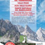 Val Vermenagna – Valle Pesio – Alta Valle Ellero
 Valle de Canfranc – Valle de Aisa – Candanchu – Astun Editorial Alpina
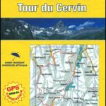 Tour of the Matterhorn / Cervino L`Escursionista Editore Map-Guide
 Tour of Saint-Bernard L`Escursionista Editore Map-Guide
 Italy/France/Switzerland: L`Escursionista Editore Maps of High Alpine Tours
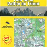 Tour of the Vallรฉe du Trient L`Escursionista Editore Map-Guide
 Alta Val Tanaro – Alta Valle Arroscia – Alta Valle Argentina
 Elba L`Escursionista Editore
Valli di Lanzo Fraternali Editore 08
Elba L`Escursionista Editore
Valli di Lanzo Fraternali Editore 08