Disclosure : This site contains affiliate links to products. We may receive a commission for purchases made through these links.
Gran Canaria F&B
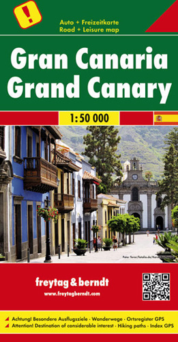
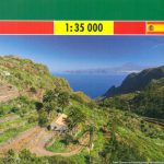
Gran Canaria at 1:50,000 on a GPS-compatible road map from Freytag & Berndt prominently highlighting the island’s main places of interest described in a multilingual booklet attached to the map cover. Many place names are in larger size print than found on most maps of the island.Gran Canaria’s landscape is presented by contours and relief shading, with plenty of names of peaks, valleys and other topographic features. Road network emphasises main roads, with interchange names prominently marked, and includes local roads and selected country tracks. Driving distances are marked on main routes. Scenic roads are highlighted, as are hiking trails. Icons indicate various facilities and places of interest, including campsites, viewpoints, etc. The island’s best sights are prominently highlighted and described in the accompanying booklet attached to the map cover. The map has a 5km UTM grid plus latitude and longitude margin ticks at 2’ intervals. The index, also in the booklet, lists locations with their GPS coordinates. Map legend and the text of sights descriptions include English.

Related Products:
 Gran Canaria F&B WKE5
 Gran Canaria Kompass 237
 Gran Canaria Marco Polo Holiday Map
 Canary Islands East: Gran Canaria, Fuerteventura, Lanzarote 500K CNIG Regional Map No.
 Canary Islands West: Gran Canaria, Tenerife, La Palma, Gomera, Hierro 500K CNIG Regional Map No. 14
 Gran Canaria K+F Outdoor Map
 111 Places in Gran Canaria That You Shouldn`t Miss
 Gran Canaria Marco Polo Pocket Travel Guide 2018 – with pull out map
 Gran Canaria Editorial Alpina 5-Map Set
 DK Eyewitness Top 10 Gran Canaria
 Gran Canaria Marco Polo Spiral Guide
 Gran Canaria Publicpress Cycling and Hiking 790
 Walking on Gran Canaria: 45 day walks including five days on the GR131 coast-to-coast route
 Gran Canaria Sunflower Landscape Guide
 Las Palmas de Gran Canaria CNIG Topo 1098
 Gran Canaria Tour & Trail Super-Durable Map
 Berlitz Pocket Guide Gran Canaria
 Canary Islands
 Corsica F&B Top 10 Tips
 La Gomera F&B
 SHOM Chart 7564 – De Gran Canaria ร Fuerteventura
 SHOM Chart 7565 – Gran Canaria, Tenerife et La Gomera
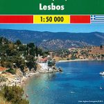 Lesbos F&B
 Admiralty Chart 1861 – Gran Canaria to El Hierro
 Gran Canaria
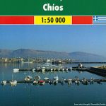 Chios F&B
 SHOM Chart 7565L – Gran Canaria, Tenerife et La Gomera – Leisure A4 size
 Madeira F&B
 Las Palmas de Gran Canaria 25K CNIG Topographic Survey Map No. 1098-IV
 Carinthia F&B Top 10 Tips
 Burgenland F&B Top 10 Tips
 Salzburg State F&B Top 10 Tips
 Abruzzo – Molise – L`Aquila – Campobasso F&B Top 10 Tips
 Tyrol F&B Top 10 Tips
 Spain – Portugal Marco Polo Map
 Albania F&B Top 10 Tips
 Styria F&B Top 10 Tips
 Peru F&B
Galdar 25K Gran Canaria CNIG Topographic Survey Map No. 1098-III
Teror 25K Gran Canaria CNIG Topographic Survey Map No. 1104-I
Peru F&B
Galdar 25K Gran Canaria CNIG Topographic Survey Map No. 1098-III
Teror 25K Gran Canaria CNIG Topographic Survey Map No. 1104-I