Disclosure : This site contains affiliate links to products. We may receive a commission for purchases made through these links.
Gorges and Monts d`Ardรจche IGN 75014

Selected tourist regions of the France on GPS compatible, contoured TOP 75 maps at 1:75,000 from the IGN, highlighting local and long-distance hiking paths, cycling routes and sites for other recreational activities. Each title includes five large panels with mapping at 1:25,000 to cover its most popular areas in greater detail. Cartography of the main map at 1:75,000 is a direct enlargement of the mapping used in the IGN’s TOP100 series. Contours are at 40m intervals, enhanced by relief shading; additional colouring shows different types of vegetation (woods, brushwood, vineyards/orchards). Boundaries of national parks and other protected areas are marked. An overprint highlights long-distance GR hiking routes and cycling trails. Symbols – more numerous than on the TOP100 maps – indicate various places of interest including mountain refuges and gรฎtes d’etape (but not campsites, see below), areas for other recreational pursuits such as climbing, hand gliding or water and winter sports, historic or cultural sites, etc. The maps have a UTM grid and an index of communes. Map legend includes English. Each title also contains five enlargements of popular areas which benefit from presentation at a more detailed scale of 1:25,000. These are extracts from IGN’s topographic survey maps and in addition to the GR routes also highlight local hiking paths and provide more information on tourist facilities including campsites.

Related Products:
 Cรฉvennes – Gorges du Tarn IGN 75011
 Cรฉzallier – Monts du Cantal IGN 75016
 Lake Geneva and Mont Blanc IGN 75007
 France: IGN 75K/25K TOP75 Recreational Maps
 Pyrรฉnรฉes Ariรฉgeoises – Mont Valier – Pique d`Estats IGN 75020
 Pyrรฉnรฉes Catalanes – Font-Romeu – Massif du Canigou IGN 75021
 Monts d`Ardรจche Didier Richard
Basque Country IGN 75023
Monts d`Ardรจche Didier Richard
Basque Country IGN 75023
 Perigord Noir – Haut-Quercy IGN 75026
 Chartreuse – Belledonne IGN 75002
 Gavarnie – Neouvielle – Luchonnais – Pic du Midi de Bigorre IGN 75019
 Haut-Languedoc IGN 75022
 Golfe du Morbihan – Belle-รle et Groix – Presqu`รle de Quiberon IGN 75017
 Chaรฎne des Puys – Massif du Sancy IGN 75015
 Pointe du Raz – Presqu`รฎle de Crozon – Ouessant – les Abers IGN 75024
 Foret d`Orient – Lac du Der-Chantecoq IGN 75039
 Ubaye – Val d`Allos – Lac de Serre-Ponรงon IGN 75008
 Massif des Ecrins – Oisans – Champsaur IGN 75006
 Monts du Lyonnais IGN 2932ET
 Brianรงonnais ‘“ Queyras IGN 75005
 Huelgoat – Monts d`Arree – PNR d`Armorique IGN 0617OT
 Monts du Cezallier – PNR des Volcans d`Auvergne IGN 2534OT
 Axat – Querigut – Gorges de l`Aude IGN 2248ET
 Vercors Massif IGN 75001
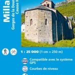 Millau – Gorges de la Dourbie – Causse Noir IGN 2641OT
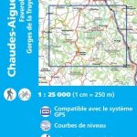 Chaudes-Aigues – Faverolles – Gorges de la Truyere IGN 2536SB
 Diois – Dรฉvoluy – Haute Vallรฉe de la Drรดme IGN 75009
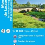 Monts de Lacaune – la Salvetat-sur-Agout – PNR du Haut Languedoc IGN 2443ET
 Sainte-Eulalie-d`Olt – Haute Vallee du Lot – Monts d`Aubrac IGN 2538OT
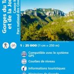
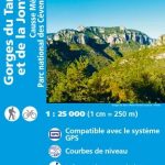 Gorges du Tarn et de la Jonte – Causse Mejan – PN des Cevennes IGN 2640OT
 Verdon – Lac de Sainte-Croix – Plateau de Valensole IGN 75013
 Gorges du Tarn et de la Jonte – Causse Mejan – PN des Cevennes IGN WATERPROOF 2640OTR
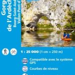 Gorges de l`Ardeche – Bourg-Saint-Andeol – Vallon-Pont-d`Arc IGN 2939OT
 Chaine des Aravis – Massif des Bauges IGN 75032
 Gorges de l`Ardeche – Bourg-Saint-Andeol – Vallon-Pont-d`Arc IGN WATERPROOF 2939OTR
Morvan IGN 75025
Norway: Turkart 50K Topographic Hiking Maps
Gorges de l`Ardeche – Bourg-Saint-Andeol – Vallon-Pont-d`Arc IGN WATERPROOF 2939OTR
Morvan IGN 75025
Norway: Turkart 50K Topographic Hiking Maps
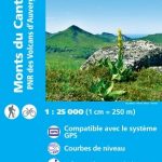 Monts du Cantal – PNR des Volcans d`Auvergne IGN 2435OT
 L`Arbresle – Monts de Tarare – Col de la Luere IGN TOP25 Map 2931ET
Baie de Somme – Cote d`Albatre – Fecamp – Etretat IGN 75036
L`Arbresle – Monts de Tarare – Col de la Luere IGN TOP25 Map 2931ET
Baie de Somme – Cote d`Albatre – Fecamp – Etretat IGN 75036