Disclosure : This site contains affiliate links to products. We may receive a commission for purchases made through these links.
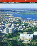
Gold Coast and Region Hema

Gold Coast and Region in Queensland in a series of maps from Hema presenting Australia’s main cities with three maps: a detailed street plan of the central area, a road map of the city with its outer suburbs, plus a map of the wider surrounding region for out-of-town excursions. The Gold Coast map has on one side street plans of the central Gold Coast area from Southport and Main Beach to Broad Beach, plus of Coolangatta ‘“ Tweed Heads, both with lists of accommodation facilities. The adjoining Gold Coast Suburban map at 1:37,300 covers an area between the South Stradbroke Island and the state border and additionally highlight surfing beaches. On the reverse a regional map at 1:70,500 of the Gold Coast and Hinterland covers a wider surrounding area including the Springbrook and Lamington National Parks.Both the suburban and the regional maps are indexed and show the road network indicating unsurfaced roads and tracks. Symbols mark roadside rest areas, campsites, accredited information centres, places of interest, etc. Topography is indicated by names of mountain ranges and selected peaks, plus rivers and lakes; national and state parks, conservation areas and reserves are all highlighted. The both maps also show postal codes.To see other titles in this series please click on the series link.

Related Products:
 Brisbane Hema
 Perth and Region Hema
 Adelaide and Region Hema
 Canberra and Region Hema
 Sydney and Region Hema
 Melbourne and Region Hema
 Cairns and Region Hema
 South East Queensland Hema
 South East Queensland – featuring Landcruiser Mountain Park Hema Explorer Map
Australia: Hema Maps of Main Cities and Surrounding Regions
South East Queensland – featuring Landcruiser Mountain Park Hema Explorer Map
Australia: Hema Maps of Main Cities and Surrounding Regions
 Lonely Planet Pocket Brisbane & the Gold Coast
 Oregon & Northern California Coast Road & Recreation Map
 Pilbara and Coral Coast Hema Waterproof Map
 Northern Territory Hema
 Victoria Hema
 Brisbane to Cairns Hema
 Orlando & Central Florida ITMB
 Argentina ACA Regional Zone 5 – Region Cuyo (incl. Aconcagua – Mendoza – San Luรญs)
 South Australia Hema
 Baltic Coast: Gdynia – Hel Peninsula – Nadmorski Regional Park
 Australia Hema Road & 4WD Atlas SPIRAL-BOUND
 Argentina ACA Regional Zone 4 – Region Centro
 Central Coast Suburban Streets NSW UBD Gregory`s 289
 Argentina ACA Regional Zone 3 – Region Litoral
 Central Queensland Hema
 Queensland Hema
 Miami – Fort Lauderdale – West Palm Beach FL Regional Rand McNally
 Australia Hema Road & 4WD Atlas PAPERBACK
 Florida Central & Eastern Regional Rand McNally
 Central Queensland – Hervey Bay to Mackay Hema
 Australia Hema Road & 4WD Easy Read Atlas SPIRAL-BOUND
 Croatia – Montenegro Coast Cartographia 2-Map Set
 Argentina ACA Regional Zone 6 – Region Buenos Aires
 Western Australia Hema
 South West Western Australia Hema
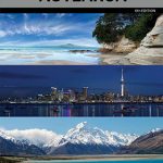 New Zealand / Aotearoa Hema
 USA Hema The Ultimate Road Atlas A3 SPIRAL-BOUND
 Western Australia Hema Road & 4WD Track Atlas A4 SPIRAL-BOUND
 Australia Hema Road & 4WD Touring Atlas A4 SPIRAL-BOUND