Disclosure : This site contains affiliate links to products. We may receive a commission for purchases made through these links.
Germany: Rhineland-Palatinate 25K Topographic Leisure Maps
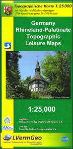
Popular recreational areas of the German state of Rhineland-Palatinate on contoured and GPS-compatible maps at 1:25,000 with cartography of the German topographic survey and extensive overprint highlighting waymarked hiking trails and/or cycling routes, plus numerous recreational facilities including campsites, youth hostels, huts, Houses of Nature and other types of accommodation, sites for various outdoor pursuits, historic buildings and other cultural heritage, etc. Cartography is identical to the countryโ€s official topographic survey and the maps provide all the information expected of survey mapping at this scale including landmarks, forest cover, etc. Contours are at 5m intervals, with additional relief shading. Many titles are double-sided to provide wider coverage on one map and/or include on the reverse additional tourist information. The maps have a UTM grid for GPS navigation. Most map legends now include English; additional tourist information such as route descriptions, notes about the region and its heritage, etc, vary โ€“ some are in German only.To see the list of titles in this series please click on the series link.

Related Products:
 Germany: Rhineland-Palatinate 50K Topographic Survey Recreational Maps
 Germany: Bavarian 50K Topographic Survey Leisure Maps
 Germany: Hesse 50K Topographic Survey Leisure Maps
 Germany: Lower Saxony 50/40K Topographic Survey Leisure Maps
 Germany: Baden-Wรผrttemberg 50K Topographic Survey Leisure Maps
 Germany: BKG 200K Topographic Maps
 Westphalia – Rhineland-Palatinate – Saarland F&B Road and Leisure Map
 Norway: Turkart 25K Topographic Hiking Maps
 Norway: Turkart 50K Topographic Hiking Maps
 Norway: Turkart 100K Topographic Hiking Maps
Germany: Bavarian 25K Topographic Maps
Norway: Turkart 100K Topographic Hiking Maps
Germany: Bavarian 25K Topographic Maps
 Germany: Alpenverein/Bavarian Survey 25K Hiking Maps
 Iceland: Topographic Hiking and Tourist Maps
 Rhineland-Palatinate – Saarland F&B
 Canada: ITMB/Canada Map Office Topographic Maps of British Columbia and the Rockies
 Iceland: 250K Topographic Survey Road Maps
 Germany: Alan Godfrey Reproductions of British War Office WWII Maps of the Rhineland
 Luxembourg: 50K Topographic Survey Maps
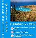 Guadeloupe/French Antilles: 25K Topographic Survey Maps
 Germany: Freytag & Berndt Hiking and Leisure Maps
 Palatinate – Palatinate Forest NP 2-Map Set Kompass 826
Martinique: IGN 25K Topographic Survey Maps
Spain: CNIG Topographic Maps of Popular Scenic Areas
Palatinate – Palatinate Forest NP 2-Map Set Kompass 826
Martinique: IGN 25K Topographic Survey Maps
Spain: CNIG Topographic Maps of Popular Scenic Areas
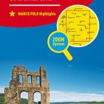 Rhineland-Palatinate – Saarland Marco Polo Regional Map 10
 Switzerland: Swiss Survey 200K Topographic Maps
Austria/Germany/Slovenia: Kompass Hiking Maps
Luxembourg: 20K Topographic Tourist Maps
Switzerland: Swiss Survey 200K Topographic Maps
Austria/Germany/Slovenia: Kompass Hiking Maps
Luxembourg: 20K Topographic Tourist Maps
 Switzerland: Swiss Survey 50K/33K Hiking Editions of Topographic Maps
 France: IGN 25K TOP25/Sรฉrie Bleue Topographic Survey Maps
 Portugal: 50K Military Topographic Survey Maps
 Hesse – Rhineland-Palatinate – Saarland K+F Regional Map
Belgium: 20K Topographic Survey Maps
Hesse – Rhineland-Palatinate – Saarland K+F Regional Map
Belgium: 20K Topographic Survey Maps
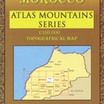 Morocco: Atlas Mountains Topographic Maps
 Central Asia: 500K Regional Topographic Maps
 Belgium: 50K Topographic Survey Maps
USA: Trails Illustrated Maps of National Parks, Forest and Other Recreational Areas
Belgium: 50K Topographic Survey Maps
USA: Trails Illustrated Maps of National Parks, Forest and Other Recreational Areas
 Russia: Topographic Maps of Elbrus and Western Caucasus
 Iceland: 100K Topographic Survey Maps
 Switzerland: Swiss Survey 100K Topographic Maps