Disclosure : This site contains affiliate links to products. We may receive a commission for purchases made through these links.
Germany and Benelux Inland Waterways Map
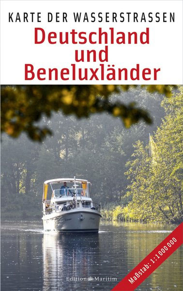
Inland waterways of Germany, Belgium, Netherlands and Luxemburg on a map at 1:1,000,000 from the Hamburg based Edition Maritim, with enlargements for Berlin area and the Ruhr, plus the Danube from Regensburg to the Black Sea.The map shows as its base the entire river network, plus main roads and within Germany the division into states. Navigable waterways are classified into six categories according to the tonnage, length, beam, draught and headroom of the vessels. Separate markings distinguish canals from rivers, with planned extensions and new canals also marked. All the navigable waterways show existing and planned locks and ship lifts, and have kilometre markings. In the coastal regions the map also indicates the extent of inland access to sea faring ships.The map extends to include north-eastern France, west to Reims and south to the confluence of Canal de Bourgogne, the Saรดne and the Rhine-Rhรดne canal, plus western Czech Republic with Vltava/Moldau and the Elbe from Kostomlรกtky. Latitude and longitude lines are drawn at 1ยบ intervals.Insets present the Berlin region and the Ruhr in greater detail at 1:500,000. The remaining part of the Danube which on the main map is covered to just beyond Linz and Mauthausen (2100kms from the Black Sea) is also shown on another inset at 1:5,000,000 approx.Map legend includes English, although only the main terms are translated.

Related Products:
 Germany – Inland Waterways
 Great Britain Collins Nicholson Inland Waterways Map
 Inland Waterways of France
 Belgium: Inland Waterways Map
 Great Britain: Inland Waterways Map
 France: Inland Waterways Map
 Ireland`s Inland Waterways
 Inland Waterways of Scotland
 France – Inland Waterways 2021
 France – Inland Waterways
Inland Waterways of France Map
France – Inland Waterways
Inland Waterways of France Map
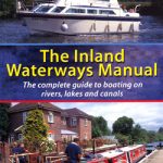 Inland Waterways Manual
 Cruising Guide to Germany and Denmark
 Belgium – Inland Waterways
France: Editions du Breil Guides to Inland Waterways
Belgium – Inland Waterways
France: Editions du Breil Guides to Inland Waterways
 Great Britain Inland Waterways
 River Thames & the Southern Waterways Collins Nicholson Waterways Guide 7
 The Inland Waterways Logbook
 NV Charts Inland Waterways Atlases
 North America Inland Waterways
 Sell Up And Cruise The Inland Waterways
 Birmingham & the Heart of England Collins Nicholson Waterways Guide 3
 Great Britain: Inland Waterways` Maps
 Four Counties & the Welsh Canals Collins Nicholson Waterways Guide 4
 Waterways Guide 3 – Birmingham and the Heart of England
 RYA Inland Waterways Handbook
 Severn, Avon & Birmingham Collins Nicholson Waterways Guide 2
 Ireland Inland Waterways
 Waterways Guide 2 – Severn, Avon & Birmingham
Cruising the Inland Waterways of France and Belgium
Waterways Guide 2 – Severn, Avon & Birmingham
Cruising the Inland Waterways of France and Belgium
 The Netherlands – Inland Waterways
 Bradshaw`s Canals and Navigable Rivers of England and Wales 1904
 North West & the Pennines Collins Nicholson Waterways Guide 5
 Grand Union, Oxford & the South East Collins Nicholson Waterways Guide 1
 Imray: UK and European Inland Waterways
 Nottingham, York & the North East Collins Nicholson Waterways Guide 6
 EuroRegs for Inland Waterways
 Waterways Past & Present: A Unique Portrait of Britain`s Waterways Heritage
 European Waterways Wall Map