Disclosure : This site contains affiliate links to products. We may receive a commission for purchases made through these links.
Georgian Caucasus – Mt Ushba – Shkhara – Kazbek terraQuest Trekking Map
The Caucasus Mountains in Georgia presented on a durable, waterproof and tear-resistant map from terraQuest, with two separate panels covering the central part including the peaks of Ushba and Shkhara with the Svaneti Range, plus the eastern region from Mount Kazbek to the Tusheti National Park.On one side a map at 1:75,000 presents the central part of the mountains, just south-east of the Elbrus massif. Coverage is centred on the town of Mestia, extending west to Lakhamula and Nakra, and east to the peak of Shkhara. The map highlights hiking and climbing trails, including their continuation across the passes on the Russian side, indicating difficult sections. Symbols mark locations with tourist accommodation, mountain refuges and bivouac places, restaurants and food shops, and various other facilities and places of interest.On the reverse the western part of the Caucasus Mountains in Georgia is shown at 1:110,000, extending east from Mkinvartsveri (Mount Kazbek) and Stepantsminda (Kazbegi) to the Russian border along the Tusheti National Park. An enlargement at 1:50,000 presents in greater detail and clarity the trail from Stepantsminda to the peak of Mt Kazbek.The cartography provides a vivid representation of the terrain with contours at 50m intervals enhanced by bold relied shading and colouring for glaciers and forested areas, plus numerous stop heights. Latitude and longitude grid is at 1’ intervals. All place names are in the Latin alphabet, with English used for facilities, places of interest, etc. Multilingual map legend includes English.The map is laminated in a format similar to the old cloth-dissected maps so that sections of it can be easily folded back without damage.

Related Products:
 Georgia – Caucasus Mountains terraQuest Adventure Map
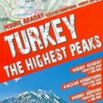 Turkey`s Highest Peaks – Mount Ararat – Kackar Mountains – Mount Suphan terraQuest Trekking Map
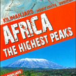 Africa`s Highest Peaks – Kilimanjaro – Mount Kenya – Rwenzori terraQuest Trekking Map
 Karakoram – K2 – Gasherbrum – Broad Peak terraQuest Trekking Map
 Tian Shan – Khan Tengri – Pobeda Peak – Lenin Peak terraQuest Trekking Map
 Fagaras – Bucegi – Piatra Craiului terraQuest Trekking Map
 Central Pyrenees terraQuest Trekking Map
 The Caucasus: A History
 Aconcagua terraQuest Trekking Map
 Caucasus F&B
 Russia: Topographic Maps of Elbrus and Western Caucasus
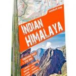 Indian Himalaya terraQuest Trekking Map
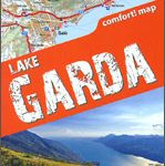 Lake Garda terraQuest Trekking Map
 Caucasus Reise Know-How
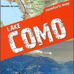 Lake Como terraQuest Trekking Map
 Ushguli – Lashkheti – Mt.Shkhara Geoland 8
 Mt Ushba – Mestia Geoland 10
 Mt Ushba – Mestia Geoland 10 WATERPROOF
 Prokletije – Durmitor – Albanian and Montenegro Alps terraQuest Trekking Map
 Caucasus Geographical Gizi Map
 Caucasus Gizi Map
 Caucasus Geographical Edition Wall Map
 Caucasus Road Edition Wall Map
 Caucasus ITMB
 Rila – Pirin terraQuest Trekking Map
 Everest Region Trekking Map
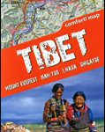 Tibet – Mount Everest – Nam Tso – Lhasa – Shigatse terraQuest Tourist Map
 Cuba terraQuest Adventure Map
 National Geographic The Caucasus – Atlas of the World 10th Edition 711 x 559 mm
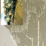 World Rail Atlas and Historical Summary: Vol. 8 The Middle East and Caucasus
 The Caucasus: An Introduction
 The Ghost of Freedom: A History of the Caucasus
 War and Peace in the Caucasus: Russia`s Troubled Frontier
 Madeira terraQuest Trekking Map
 Top End National Parks: Litchfield – Katharine – Kakadu Hema
 Torres del Paine Trekking Map
 Peak District National Park Pocket Map
 Mount Xixabangma