Disclosure : This site contains affiliate links to products. We may receive a commission for purchases made through these links.
Georgia: Russian Invasion and Occupation Map as of 16.9.2009
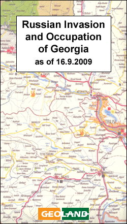
Georgia on a large wall map from the Tbilisi bases Geoland overprinted with information relating to the armed conflict with Russia in 2008, including occupied areas, artillery and air attacks, etc. The base is the publishers’ road map of the country which also shows its administrative division into provinces, including Abkhazia and South Ossetia.Colouring shows territory controlled by the Georgian Government or by the separatist movements prior to 8th August 2008, areas subsequently occupied by Russian forces or subject to ethnic cleansing, etc. Extensive overprint shows various points of conflict, with symbols indicating locations attacked at different stages of fighting, destruction of infrastructure, etc.Map legend is in English.

Related Products:
 Chechnya – Tombstone of Russian Power
 Georgia: Geoland 200K Regional Travel Maps
 Atlas of Russian History
 Georgia Geoland Road Map WATERPROOF
 Georgia & Armenia ITMB
 Kingdom of Olives and Ash: Writers Confront the Occupation
 Short Stories in Russian for Beginners: Read for pleasure at your level, expand your vocabulary and learn Russian the fun way!
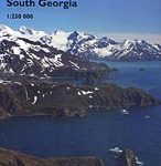
 South Georgia Explorer
 Busen Region – South Georgia BAS Wall Map
 Short Stories in Russian for Intermediate Learners: Read for pleasure at your level, expand your vocabulary and learn Russian the fun way!
 Cรณdigo Is 2008 (Ediciรณn 2009)
 Moon Georgia
 Georgia – Caucasus Mountains terraQuest Adventure Map
 The Russian Civil War
 Georgia Easy to Fold Rand McNally
 Thatcher Peninsula – South Georgia BAS Wall Map
 Busen Region – South Georgia BAS
 Tasting Georgia: A Food and Wine Journey in The Caucasus
Georgia Easy-to-Read Rand McNally
Tasting Georgia: A Food and Wine Journey in The Caucasus
Georgia Easy-to-Read Rand McNally
 World War II – Invasion to Liberation
 Georgia Reise Know-How
Dirty Russian: Second Edition: Everyday Slang from `What`s Up?` to `F*%# Off!`
Georgia Reise Know-How
Dirty Russian: Second Edition: Everyday Slang from `What`s Up?` to `F*%# Off!`
 The Anna Karenina Fix: Life Lessons from Russian Literature
 Edge of Empires, a History of Georgia
 Moon Carolinas & Georgia
 Thatcher Peninsula – South Georgia BAS
 South Georgia BAS Geological Map 4
 St Andrews Bay – Royal Bay, South Georgia BAS Geomorphology Map
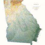 Georgia State Physical Wall Map
 Edge of Empires: A History of Georgia
 A Russian Jew Of Bloomsbury
 The History of the Russian Revolution
 What You Did Not Tell: A Russian Past and the Journey Home
 The Russian Way
St Andrews Bay – Royal Bay, South Georgia BAS Geomorphology Wall Map
The Russian Way
St Andrews Bay – Royal Bay, South Georgia BAS Geomorphology Wall Map
 Tolstoy: A Russian Life
 Backroads & Byways of Georgia
 The Kremlin Conspiracy: 1,000 Years of Russian Expansionism
 The Penguin Book of Russian Poetry