Disclosure : This site contains affiliate links to products. We may receive a commission for purchases made through these links.
Georgia Reise Know-How
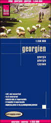
Georgia at 1:350,000 on an indexed, waterproof and tear-resistant road map with topographic and tourist information, published by Reise Know-How as part of their highly acclaimed World Mapping Project. All place names are in the Latin alphabet, with larger towns also in the Georgian script, plus in Abkhazia in Cyrillic.The map is double-sided, dividing the country east/west with a good overlap between the sides, and shows Abkhazia and South Ossetia as administrative provinces of Georgia, although their currently different status is indicated by inclusion of signs for ‘closed frontier crossings”.Topography is indicated by light, unobtrusive altitude colouring, plus plenty of names of mountain ranges, peaks and passes with heights, glaciers, etc. National parks and other protected areas are highlighted. Road network includes selected unpaved seasonal tracks and gives driving distances on main routes. Railway lines are shown and local airports are marked. Symbols highlight various places of interest including UNESCO World Heritage sites, archaeological remains, religious buildings, beaches, winter sports area, etc. The map has latitude and longitude lines at 20’ intervals and is indexed. Map legend includes English.”World Mapping Project” is an extensive series of maps at varying scales, aiming to provide coverage of countries and regions worldwide using clear, well presented cartography with both topographic and tourist information.

Related Products:
 Afghanistan Reise-Know-How Map
 Sri Lanka Reise Know-How
 Taiwan Reise Know-How
 Lebanon – Beirut Reise Know-How
 Italy North Reise Know-How
 Central America Reise-Know-How Map
 Albania Reise Know-How
 Czechia Reise Know-How
 Saudi Arabia Reise Know-How
 Corfu Reise Know-How
 Trinidad and Tobago Reise Know-How
 Ghana – Togo Reise Know-How
 Tuscany Reise Know-How
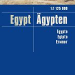 Egypt Reise Know-How
 Kazakhstan Reise Know-How
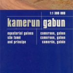 Cameroon & Gabon Reise-Know-How Map
 Italy Reise Know-How
 Azores Reise Know-How
 Hungary Reise Know-How
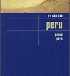 Peru Reise Know-How
 Iran Reise Know-How
 Lithuania Reise Know-How
 Georgia: Geoland 200K Regional Travel Maps
 Rhodes Reise-Know-How
 Algarve Reise Know-How
 Ukraine Reise Know-How
 China Reise Know-How
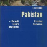 Pakistan Reise Know-How
 Bolivia Reise Know-How
 Crete Reise Know-How
 Africa Southern Reise Know-How
 Sweden South Reise Know-How
 Africa West – Sahara Reise Know-How
 Syria – Lebanon Reise Know-How
 Georgia Geoland Road Map WATERPROOF
 Jordan Reise Know-How
Georgia
Jordan Reise Know-How
Georgia
 Libya Reise Know-How
 Myanmar / Burma Reise Know-How