Disclosure : This site contains affiliate links to products. We may receive a commission for purchases made through these links.
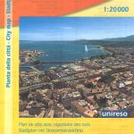
Geneva CityPocket Street Plan
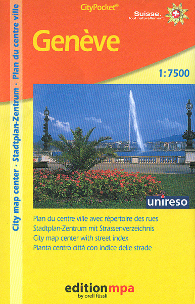
Geneva’s central districts on a handy size street plan at 1:7,500 from Editions MPA with cartography from the Swiss publishers Orell Fรผsli, showing bus and tram routes with stops and line numbers. Coverage extends north to La Perle du Lac park (so does not include the UN Palais des Nations), south to the La Cluse medical complex, and west along the Rhรดne just beyond the railway bridge.Tram and bus routes are shown with stops and line numbers; the plan also shows ferry terminals and connections across Lake Geneva, taxi ranks and car parks. Locations of over 90 hotels are highlighted and cross-referenced to a list which is included with the street index. Symbols indicate various places of interest and facilities including museums, supermarkets, etc. A separate panel shows a map of bus, tram and ferry connections within the area covered by the main plan. Map legend includes English.

Related Products:
 Geneva: Greater Geneva Street Plan
 Jurmala Jana Seta Street Plan
 Constanta Cartographia Street Plan
 Geneva & Switzerland ITMB
 Sofia Domino Street Plan
 Lviv ExpressMap Street Plan
 Linz F&B Tourist Street Plan
 Bishkek Street Plan
 Poznan ExpressMap Street Plan
 Warsaw – Lomianki – Zabki ExpressMap Street Plan
 Riga City Center Jana Seta Street Plan
 Kaunas Jana Seta Street Plan WATERPROOF
 Salzburg F&B Tourist Street Plan
Lodz ExpressMap Street Plan
Salzburg F&B Tourist Street Plan
Lodz ExpressMap Street Plan
 Basel Pocket Street Plan
 Katowice ExpressMap Street Plan
 Zurich & Switzerland NW ITMB
 Bratislava Street Plan
 Lublin – Swidnik ExpressMap Street Plan
 Czestochowa ExpressMap Street Plan
 Riga and Vicinity Jana Seta Street Atlas
 Wroclaw ExpressMap Street Plan
 Iasi Cartographia Street Plan
 Marrakech – Medina Street Plan
 Kaunas Jana Seta Street Plan
 Bangkok Walks Street Plan
 Geneva
 Vilnius Jana Seta Street Plan WATERPROOF
 Szczecin – Swinoujscie – Police ExpressMap Street Plan
 Gothenburg Pocket Atlas
 Gdansk – Gdynia – Sopot (The Tricity) ExpressMap Street Plan
Kielce ExpressMap Street Plan
Gdansk – Gdynia – Sopot (The Tricity) ExpressMap Street Plan
Kielce ExpressMap Street Plan
 Krakรณw – Niepolomice – Skawina – Wieliczka ExpressMap Street Plan
 Larmaka Street Plan and District Road Map
 Salzburg F&B Street Plan
 Helsinki City Map
 Barcelona “Maps to Go” Street Plan
 Innsbruck F&B Tourist Street Plan
 Limassol Pocket Street Plan
 Moscow Jana Seta Street Plan