Disclosure : This site contains affiliate links to products. We may receive a commission for purchases made through these links.
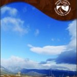
Gaularfjellet Nordeca Tourist Route 20007
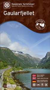
This Gaularfjellet National Tourist Route Map belongs to a series of 18 map and postcards sets describing popular tourist routes all over Norway. The map set includes a map in 1: 50,000 presenting an accurate topography (based on the Norwegian topographic survey) which describes local footpaths, cycle or ski routes, sport and recreational facilities, places of interest, places to stay and eat, viewpoints.Gaularfjellet National Tourist Route is a 130-kilometre-long stretch of road between Balestrand in Sogn and Moskog and Sande in Sunnfjord in the county of Sogn og Fjordane in Fjord Norway. The protected Gaular Watercourse, with its many lively rapids, waterfalls and shining lakes, is like a row of pearls along Gaularfjellet National Tourist Route. The drive is exciting and varied, along narrow fjords, on twisting roads up steep mountainsides, over high mountains and back down sheltered valleys. The route offers a peaceful alternative to the main roads between Sogn and Sunnfjord. Here children and adults can experience trout fishing at its best and wander on good paths beside waterfalls and rapids. It is also possible to rent a boat or take a walk in the mountains. In Balestrand there are museums and galleries and a wide selection of services.There is one panoramic view and rest area: Likholefossen features a parking lot, small rest area and a footbridge across one of the many rapids in the Gaula River. From the bridge you can walk along the “river path” skirting the protected river. The set features:One map: scale 1:50,000 Text in three languages (Norwegian, English and German)5 Postcards (13.5x25cm)To see the list of other titles in this series, please click on the series link.

Related Products:
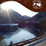
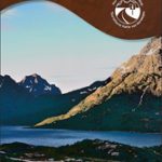
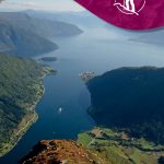
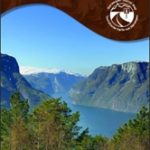 Aurlandsfjellet Nordeca Tourist Route 20005
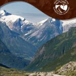
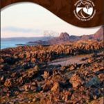
 Ryfylke Nordeca Tourist Route 20002
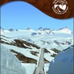
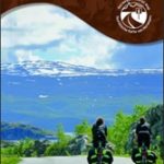
 Old Strynefjellsvegen Nordeca Tourist Route 20009
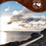
 Sognefjellet Nordeca Tourist Route 20008
 Havoysund Nordeca Tourist Route 20017
 Valdresflye Nordeca Tourist Route 20006
 Lofoten Nordeca Tourist Route 20014
 Varanger Nordeca Tourist Route 20018
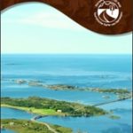
 Helgeland Coast North Nordeca Tourist Route 20013
 Atlantic Road Nordeca Tourist Route 20012
 Denmark Tourist Map – Major Cities with the Marguerite Route
Garden Route & Route 62 Map Studio
Denmark Tourist Map – Major Cities with the Marguerite Route
Garden Route & Route 62 Map Studio
 Indre Sunnfjord Nordeca 2481
 Balestrand Nordeca 2810
 Slovakia Shocart 50K Tourist Atlas
Ypres Salient: Tourist Car Route 1914-1918
Slovakia Shocart 50K Tourist Atlas
Ypres Salient: Tourist Car Route 1914-1918
 Etruscan Coast – Pisa – Livorno – Piombino Global Map Tourist Map
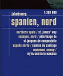 Spain North – Santiago Route Reise Know-How
Glan-Blies Route – Barbarossa Route – incl Lauertal Route Bikeline Map-Guide Compact
Spain North – Santiago Route Reise Know-How
Glan-Blies Route – Barbarossa Route – incl Lauertal Route Bikeline Map-Guide Compact
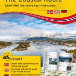
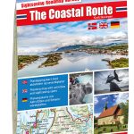 The Coastal Route Nordeca Sightseeing Map 6009
 Canning Stock Route Design Interaction Guide
 Lower Glenelg and Discovery Bay: The Great South-West Walk Route, VIC/SA
 Tatra Tourist Attractions (Dookola Tatr)
 Pacific Coast Route: Seattle to San Diego
 Colorado Backcountry Discovery Route Butler Motorcycle Maps
 The Salmon Run – Dundee to Pitlochry Cycle Route
 The Coastal Route Nordeca Sightseeing Map 6029
 Stromberg-Murrtal Cycle Route – Idyllic Route
Maremma – Grossetana Global Map Tourist Map
Stromberg-Murrtal Cycle Route – Idyllic Route
Maremma – Grossetana Global Map Tourist Map
 Main River Cycle Route Bikeline Map-Guide
 Mecsek – Villรกny Mountains Cartographia Tourist Map 15
 Poland`s Tourist Attractions Map
 Latgale South Jana Seta Tourist Map
Kurzeme North Jana Seta Tourist Map
Latgale South Jana Seta Tourist Map
Kurzeme North Jana Seta Tourist Map
 Kurzeme South Jana Seta Tourist Map
 Central Latvia Jana Seta Tourist Map
 Vidzeme North Jana Seta Tourist Map
International Dollard Route – German Fehn Route Bikeline Map-Guide
Vidzeme North Jana Seta Tourist Map
International Dollard Route – German Fehn Route Bikeline Map-Guide
 Drau / Drava Cycle Route – from Source to River Mur Bikeline Map-Guide
 Lochs & Glens North Cycle Route