Disclosure : This site contains affiliate links to products. We may receive a commission for purchases made through these links.
Garajonay National Park – Gomera CNIG Map-Guide SPANISH
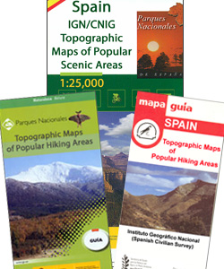
La Gomera, including the Garajonay National Park, at 1:25,000 on a contoured and GPS compatible map from IGN/CNIG with cartography from their topographic survey of Spain. The map is accompanied by a Spanish language guide with descriptions of walks, contact details for recommended accommodation, etc. The map has contours at 10m intervals enhanced by relief shading, plus colouring and graphics to show different types of vegetation. Hiking trails are highlighted, indicating routes which are described in the guide. A wide range of symbols indicate various facilities and places of interest, including different types of accommodation (campsites, refuges, etc), sites for other recreational pursuits, bird watching locations, etc. The map has a 1km UTM grid and margin ticks for latitude and longitude. Map legend includes English. On the reverse there are satellite images of the island and notes on its history and legends.The accompanying guide is in Spanish and describes 13 walks within the Garajonay National Park, plus 15 more trails outside the park boundary. Also included are suggestions for other recreational activities. The guide provides phone numbers for various accommodation options, general notes about the area, etc.To see the English version of this title and a list of other titles in this series please click on the series link

Related Products:
 Garajonay National Park – Gomera CNIG Map-Guide ENGLISH
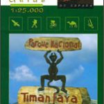
 Timanfaya National Park – Lanzarote CNIG Map-Guide SPANISH
 Monfragรผe National Park CNIG Map-Guide SPANISH
 Donana National Park CNIG Map-Guide SPANISH
 Aiguestortes i Estany de Sant Maurici National Park CNIG Map-Guide SPANISH
 Cabaรฑeros National Park CNIG Map-Guide SPANISH
 La Tablas de Daimiel National Park CNIG Map-Guide SPANISH
 Timanfaya National Park – Lanzarote CNIG Map-Guide ENGLISH
Teide National Park – Tenerife CNIG Map and Guide Set SPANISH
Cabrera and the Adjoining Islands National Park CNIG Map-Guide SPANISH
Islands of the Galician Coast National Park CNIG Map-Guide SPANISH
Timanfaya National Park – Lanzarote CNIG Map-Guide ENGLISH
Teide National Park – Tenerife CNIG Map and Guide Set SPANISH
Cabrera and the Adjoining Islands National Park CNIG Map-Guide SPANISH
Islands of the Galician Coast National Park CNIG Map-Guide SPANISH
 Caldera de Taburiente NP – La Palma CNIG Map-Guide SPANISH
Picos de Europa National Park 3-Map and Guide Set CNIG SPANISH
Caldera de Taburiente NP – La Palma CNIG Map-Guide SPANISH
Picos de Europa National Park 3-Map and Guide Set CNIG SPANISH
 Sierra de Guadarrama National Park 4-Map and Guide Set CNIG
 Picos de Europa National Park 3-Map and Guide Set CNIG ENGLISH
 Caldera de Taburiente NP – La Palma CNIG Map-Guide ENGLISH
 Teide National Park – Tenerife CNIG Map-Set
 Stelvio National Park Walking Guide – Italy`s Largest Alpine National Park
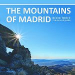 Spanish Trails – A Guide to Walking the Spanish Mountains – The Mountains of Madrid
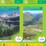 Ordesa and Monte Perdido National Park 2-Map Set
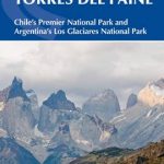 Torres del Paine: Chile`s Premier National Park and Argentina`s Los Glaciares National Park
 Spanish Trails – A Guide to Walking the Spanish Mountains: Book one: Picos De Europa
 Auyuittuq National Park, Nunavut
Wapusk National Park, Manitoba
Sirimilik National Park, Nunavut
Ukkusiksalik National Park, Nunavut
Vuntut National Park, Yukon
Ivvavik National Park, Yukon
Auyuittuq National Park, Nunavut
Wapusk National Park, Manitoba
Sirimilik National Park, Nunavut
Ukkusiksalik National Park, Nunavut
Vuntut National Park, Yukon
Ivvavik National Park, Yukon
 Ordesa and Monte Perdido National Park Editorial Alpina
 Sierra de Huetor Natural Park Editorial Penibetica SPANISH
Grasslands National Park: East Block, Saskatchewan
Grasslands National Park; West Block Saskatchewan
Tuktut Nogait National Park, Northwest Territories
Sierra de Huetor Natural Park Editorial Penibetica SPANISH
Grasslands National Park: East Block, Saskatchewan
Grasslands National Park; West Block Saskatchewan
Tuktut Nogait National Park, Northwest Territories
 Sierra de las Nieves National Park CNIG 2-Map Set and Guide
Aulavik National Park, Northwest Territories
Sierra de las Nieves National Park CNIG 2-Map Set and Guide
Aulavik National Park, Northwest Territories
 Bavarian Forest National Park – Nature Park East UK50-29
 Spanish Trails – A guide to walking the Spanish mountains: Book Two: The Sierra Almijara and Tejeda
Nahanni National Park Reserve, Northwest Territories
Spanish Trails – A guide to walking the Spanish mountains: Book Two: The Sierra Almijara and Tejeda
Nahanni National Park Reserve, Northwest Territories
 Top Trails: Olympic National Park and Vicinity: Must-Do Hikes for Everyone
 Waterton Lakes National Park Gem Trek Map