Disclosure : This site contains affiliate links to products. We may receive a commission for purchases made through these links.
Galway – Longford – Roscommon – Westmeath OSI Discovery 40
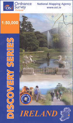
Map No. 40, Roscommon Central – Longford West in the Discovery series from the OSI, the Ordnance Survey of Ireland, which presents the country on detailed topographic maps at 1:50,000, with additional overprint highlighting campsites and caravan parks, youth hostels, etc. Current 3rd edition of this title was published in March 2011.Maps in the Discovery series have contours at 10m intervals, with plenty of spot heights and additional altitude colouring. Graphics indicate different types of woodlands. An overprint highlights waymarked or unmarked walking trails as well as cycle routes. National or forest parks and nature reserves are marked and a range of symbols provide tourist information: campsites, caravan parks, youth hostels (An ร“ige and independent), tourist offices, parking and picnic places, and viewpoints. Golf courses indicate the number of holes. The maps also highlight antiquities and historical sites such as megalithic tombs, standing stones, battlefields, etc. Road network grades third class roads according to their widths and includes local tracks. Railways are shown with stations and the maps include other details expected of topographic mapping at this scale. Where appropriate, place names are given in both Irish and English.Each map covers an area of 40 x 30km (25 x 19 miles approximately) and has a 1km ITM (Irish Transverse Mercator) grid, plus latitude and longitude margin ticks at 1` intervals. Map legend is in Irish and English. To see the list of all the titles in this series please click on the series link.

Related Products:
 Longford – Meath – Westmeath OSI Discovery 41
 Leitrim – Longford – Roscommon – Sligo OSI Discovery 33
 Galway W OSI Discovery 44
 Sligo – Leitrim – Roscommon OSI Discovery 25
 Clare – Galway OSI Discovery 51
 Mayo – Roscommon – Sligo OSI Discovery 32
 Meath – Westmeath OSI Discovery 42
 Kildare – Meath – Offaly – Westmeath OSI Discovery 49
 Donegal SW OSI Discovery 10
 Cork OSI Discovery 86
 Wexford OSI Discovery 69
Waterford SE OSI Discovery 82
Clare OSI Discovery 57
Cork S OSI Discovery 87
Kerry OSI Discovery 83
Wexford OSI Discovery 69
Waterford SE OSI Discovery 82
Clare OSI Discovery 57
Cork S OSI Discovery 87
Kerry OSI Discovery 83
 Mayo OSI Discovery 23
 Donegal NE OSI Discovery 3
 Donegal N OSI Discovery 2
Mayo SW – Galway NW OSI Discover 37
Donegal – Tyrone OSI Discovery 6
Donegal N OSI Discovery 2
Mayo SW – Galway NW OSI Discover 37
Donegal – Tyrone OSI Discovery 6
 Kerry (Dingle) OSI Discovery 70
 Kerry OSI Discovery 78
Kilkenny – Tipperary – Waterford OSI Discovery 75
Donegal NW OSI Discovery 1
Laois – Offaly – Tipperary OSI Discovery 54
Cork Central OSI Discovery 80
Kerry OSI Discovery 78
Kilkenny – Tipperary – Waterford OSI Discovery 75
Donegal NW OSI Discovery 1
Laois – Offaly – Tipperary OSI Discovery 54
Cork Central OSI Discovery 80
 Cork – Kerry OSI Discovery 85
 Mayo NW OSI Discovery 22
Clare – Limerick – Tipperary OSI Discovery 65
Mayo NW OSI Discovery 22
Clare – Limerick – Tipperary OSI Discovery 65
 Cork SW OSI Discovery 88
 Armagh – Down – Louth – Meath – Monaghan OSI Discovery 36
 Mayo Central OSI Discovery 31
 Dublin – Meath – Kildare – Wicklow OSI Discovery 50
 Cavan – Louth – Meath – Monaghan OSI Discovery 35
 Donegal – Fermanagh – Tyrone OSI Discovery 11
 Mayo West-Central OSI Discovery 30
 Kerry OSI Discovery 78 WATERPROOF
Carlow – Kilkenny – Waterford – Wexford OSI Discovery 76
Clare – Kerry OSI Discovery 63
Kerry OSI Discovery 78 WATERPROOF
Carlow – Kilkenny – Waterford – Wexford OSI Discovery 76
Clare – Kerry OSI Discovery 63
 Galway – Roscommon – Offaly – Westmeath OSI Discovery 47